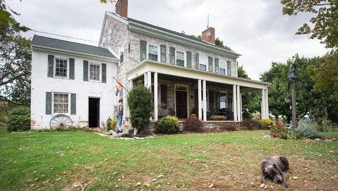
Efforts to save the historic Mifflin House, a stop on the Underground Railroad, have grown into a bigger vision to attract visitors to the region.
It could become part of a regional visitor center that shares the local history and how it ties into the American story, said Mark Platts, president of the Susquehanna National Heritage Area.
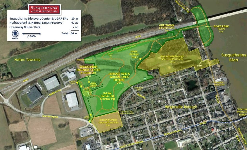
The barns would become a Susquehanna Discovery Center, a regional welcome and interpretive site that would include exhibit galleries and offices for Platts’ organization. Outside, visitors could see where a Civil War skirmish happened just before the burning of the bridge at Wrightsville.
The Mifflin House, which served as a stop on the Underground Railroad and witnessed a skirmish during the Civil War, could become part of a regional visitor destination site. Efforts to save the house have been ongoing for several years, and the vision for the area has grown to include a Susquehanna Discovery Center, trails and a connection to the Susquehanna River. The land is located off of Route 30 in eastern York County.
Preservationists have been working for years to save the Mifflin House, which sits in a growing business park in Hellam Township. In 2019, they reached an agreement with Kinsley Properties, giving organizations two years to raise funds to preserve the farmhouse, the barn and 62 acres.
The deadline has passed, but preservationists recently made an offer to buy the property, said Mindy Crawford, executive director of Preservation Pennsylvania.
“We’re still in negotiation, but we’re feeling really positive,” she said.
The Conservation Fund would likely purchase the property, and the Susquehanna National Heritage Area would own it, she said. A similar process was used to preserve the site of Camp Security, a Revolutionary War prison camp in neighboring Springettsbury Township.
The Mifflin House and the land it sits on are owned by Wayne and Susan Blessing and Robert and Agnes Blessing. Kinsley Properties has been developing the land for the family.
The Mifflin House, in Hellam Township, with its a brick summer kitchen at left, had been in jeopardy of being demolished. Historic preservationists, noting its connection to the Underground Railroad, are working on a plan to save it and create a regional visitor center.
How the concept evolved
While preservationists voiced opposition to the proposed demolition of the historic house during the land development process, Crawford tried to talk with the developer and the owners about possibly developing a preservation plan.
Eventually, Preservation Pennsylvania began discussing the property with the Conservation Fund and the Susquehanna National Heritage Area. Both had been involved in the effort to save Camp Security.
The organizations decided to work together. During the meetings, Platts came up with an idea to protect the property and do an interpretation on the house with its Underground Railroad connection, Crawford said.
At that time, it was not for the heritage area’s use, she explained. It wasn’t until later that the heritage area board saw this property as a potential new gateway for the group’s national designation.
The organizations met with Tim Kinsley, president and CEO of Kinsley Properties, and his attorney to discuss the possibilities. An appraisal was done, and they tried to find sources for funding it.
Preservation Pennsylvania vowed to keep working on it until it is — or isn’t — successful.
Funding started to fall into place, and an official offer on the property was made a few weeks ago, Crawford said. It would involve more acreage than originally proposed.
The concept is a great use for the property, she said. It would preserve the house as well as the open space.
“Discussions with the preservationists about the Mifflin House are ongoing, but no final agreement has been reached,” Kinsley Properties said in a statement.
Grant, other funding to help with project
The concept plan lists acquisition and related costs at $4,250,000. It proposes saving more land — 77 acres — but would leave some property for development close to Wrightsville borough, Platts said.
The overall project, including design and construction, is estimated to cost $13.4 million. It could take five to eight years, after acquisition, for full development.
So far, the organization has raised more than $3 million.
Randolph Harris, a consulting historian in Lancaster County, said the concept, if it falls into place, would make a perfect attraction.
It would help visitors understand the connection between the burning of the bridge in Wrightsville to the Battle of Gettysburg.
It also would allow visitors to trace the steps that freedom seekers took on the Underground Railroad as they left York County and crossed the Susquehanna River into Lancaster County.
Columbia Borough plans to expand its park north of the Route 426 bridge, where the old bridge piers and remnants of the Pennsylvania Canal exist. The bridge and boats helped the freedom seekers to escape.
Harris, who gives private Underground Railroad tours, said he starts near the Mifflin House and moves east. Participants are enthralled to hear how it came together in the Susquehanna River area.
Preservation Pennsylvania listed the Mifflin House as one of the state’s most endangered historic resources in 2017. It is considered to be historically significant enough to be eligible for being included on the National Register of Historic Places, the Pennsylvania State Historic Preservation Office has determined.
It’s not unusual for a project to take several years to come together, Crawford said. It takes a property about seven years to go from at-risk to saved.
The Susquehanna National Heritage Area serves York and Lancaster counties, and its offices currently are located at the Zimmerman Center for Heritage in Lower Windsor Township.
Both the Zimmerman Center and the Columbia Crossing River Trails Center, which is on the Lancaster County side, would remain in use if the Susquehanna Discovery Center comes to fruition, Platts said. The organization offers free river discovery tours from the Zimmerman Center.
Susquehanna NHA has partnered with Marietta Area Business Association to build a list of great things to see, do, buy, and eat in this historic lumber town. Spring is our favorite season for Marietta because the cherry trees lining Front Street bloom in April. So we invite you to come explore whether you live in town or you’re visiting for the day. With over 25 activities featuring Marietta organizations, businesses, events, and landmarks there is something for everyone!
Susquehanna National Heritage Area started the Bucket List to keep our river towns busy during the 2020 global pandemic. The goal was to capture and share great experiences like shopping and eating at some of the local businesses, visiting heritage sites and learning about the town’s history, as well as appreciating the expanding connections to outdoor recreation opportunities. Anyone can use the list to take a unique and authentic journey through one of our beautiful river towns. In 2021, enjoy three lists to keep you busy starting as spring blooms in Marietta, then turning up the heat in Columbia during the summer and ending with the changing leaves in Wrightsville this fall. America’s 55th National Heritage Area is here to connect you to all the cultural discovery and outdoor fun the Susquehanna has to offer.
River Roots is Susquehanna NHA’s blog series featuring history from York and Lancaster Counties that showcases the Susquehanna River’s historic, cultural, and natural resource contributions to our nation’s heritage.
Stories of the Underground Railroad are inherently difficult to uncover and share. Unlike military or political history, few primary written records exist because assisting those escaping slavery was illegal and punishable with prison time and fines. Many enslaved people escaped without assistance and many supporters of the underground railroad were involved only periodically or occasionally. Stringing together the routes of the network, safe houses, and transportation methods has become a challenging but essential research interest of historians across the United States.
The Lower Susquehanna River Valley is particularly unique as the counties of York and Lancaster were hotbeds of abolitionist sentiment and Underground Railroad activity. Stories have been passed down from generation to generation about barns, basements, and cellars being used as hiding places. Historians sift through wills, deeds, newspaper ads, and genealogical information across multiple states and countries to tell the story of enslaved people, who became the agents of their own liberation. These accounts should not go unnoticed because the Underground Railroad story is a classic American story of “underdogs fighting the system with or without outside assistance.” (Leroy Hopkins in introduction to The Ground Swallowed Them Up.)
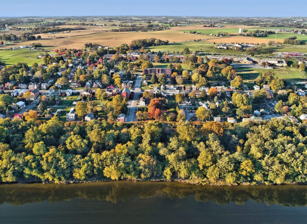
In the Susquehanna National Heritage Area, one site holds more definitive Underground Railroad history and significance than many others. It is the Hybla property just outside the town of Wrightsville in Hallam Township. Many people may know this property as the Mifflin Farm or Wright Mifflin Farm.
The Home at Hybla
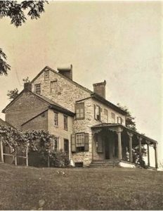
19th Century View of Hybla Home from York County History Center
The first purchaser of the property was John Wright Sr., who established the ferry across the Susquehanna River in 1730 from present-day Columbia. He purchased hundreds of acres on the west side of the river in what became Hallam Township and passed it down to his children. There is contradicting accounts as to whether John Wright Sr. or his son James Wright erected the home on the property. James Wright died in 1788 and divided the property between his children. James’s daughter, Susanna, was given a 108-acre tract on which the Mifflin house is located. Susanna Wright Mifflin and her husband Jonathan Mifflin moved into the home on the property in 1800 after they married. They named the property Hybla.
After their deaths in 1829 and 1840, their son Samuel W. Mifflin lived at Hybla until 1846. During the nearly 50 years that the Mifflin family called Hybla home the Underground Railroad became the primary method to free enslaved people from southern states that refused to abolish the practice. Pennsylvania and many other Northeastern states had enacted gradual abolition of slavery before the turn of the century. The Wright and Mifflin families were staunch abolitionists. Their Quaker religion held that all people were equal under the eyes of God. Therefore, they should all be treated equally. It was not overnight that the Quakers chose to vehemently oppose slavery, but over the course of a century between 1675 – 1775 the religion developed a solid stance against the practice. Susanna, Jonathan, and their son Samuel were committed abolitionists publicly denouncing slavery at Quaker meetings and privately channeling freedom seekers across the Susquehanna River for half a century.
Underground Railroad at Hybla
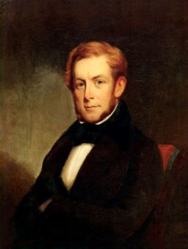
Samuel W. Mifflin
In the early 1880s, Dr. Robert C. Smedley decided to record and publish accounts of Underground Railroad experiences in Southeastern Pennsylvania from interviews with its agents, conductors, and stationmasters. His narrative showcases primarily the free white supporters of freedom seekers and captures their memories of Underground Railroad activities. Smedley features Samuel W. Mifflin in his work History of the Underground Railroad in Chester and the neighboring counties of Pennsylvania. The account offers multiple stories of fugitives staying on the Hybla property, in the home, as well as being shuttled across the Susquehanna. Each short narrative showcases an important element or principle of the Underground Railroad’s operation.
“As far back in his boyhood as he can remember Samuel was accustomed to seeing fugitives passed along by different members of their family.” On one occasion, he recalled a freedom seeker was hidden in a cornfield and fed day after day by a cousin. The cousin would go out with his gun as if to hunt but his game bag was filled with provisions. (p. 48-49) It was very common for Quakers or abolitionists to offer a safe location on the property but not necessarily in the home. Cellars, barns, and in this instance, cornfields could be used to conceal freedom seekers, allowing them a few hours or days rest and recuperation before continuing their journey.
On a visit home to see his ailing father, Samuel found “the parlor occupied by thirteen fugitives. They comprised two families of men, women, and children whom his elder brother found wandering in the neighborhood. The windows were closed to prevent discovery, and a lamp kept burning all day. They were thus guarded during two days and nights of stormy weather and high water in the Susquehanna which prevented their crossing the river. On the third night they were transferred to the care of Robert Loney who ferried them over to the Columbia shore.” (p. 49)
This story, in particular, reveals an important element of the Underground Railroad that can be misunderstood – that African Americans were only shuttled to freedom by white abolitionists. In reality, African Americans were not passive figures but agents of their own liberation. These two families were found wandering and brought to the home. It is possible they had been assisted by a free Black or another white abolitionist and were told to head to Wrightsville on their path to freedom. It is also possible they headed to Wrightsville from rumors that the river there was the border with Canada. It was a common misconception because of how wide the river was at Wrightsville. Either way, it is important to remember that African Americans undertook the primary risk and struggle for freedom. There was a broad range of experiences and many made it without the support of the Underground Railroad network.
By far the most detailed story Smedley recounts about Hybla is that of Perry Wilkinson, an enslaved man and Baptist preacher. He was brought by a guide to the Mifflin’s at ten in the evening. Although he was offered a bed, Perry would not eat and paced the floor all night. He was thinking of his wife and family whom he had left behind. Perry had been enslaved in Anne Arundel, MD and was hired out on a boat that traveled between his master’s wharf and Baltimore. When his master died, Perry received word from a friend that his widow had decided to sell Perry. As soon as the boat landed in Baltimore, Perry journeyed north, traveling by night and hiding in the woods each day until he reached York and was brought to Samuel Mifflin. (p. 50-51) Although some freedom seekers had the opportunity to plan their journey, many others were forced, like Perry, to make a quick, deliberate, and difficult decision. No matter the choice that Perry made he would be separated from his family in a matter of days. Perry’s story is a representation of a truly dehumanizing nature of the chattel slavery in the United States.
Hybla’s Place in the Network to Freedom
Network Identified by Switala in Underground Railroad in Pennsylvania
Although there were thousands of unique experiences for fugitives on the path to freedom, historians have found some patterns in the routes. Dr. William Switala, a former professor at Duquesne University, studied these patterns and consistently found that the Underground Network between York and Lancaster County was connected across the river in three primary locations: York Haven – Middletown; Wrightsville – Columbia; and at the Peach Bottom Ferry. The York Haven – Middletown ford and ferry were used by freedom seekers that came through Lewisberry, a primarily Quaker town. Peach Bottom Ferry was primarily used by a conductor in Havre de Grace who would shuttle freedom seekers up through southern York County. The Wrightsville – Columbia connection was used more frequently than the other two for two primary reasons.
Columbia had a large free black population. When the town was laid out in 1787 the northeastern corner of town was set aside for manumitted slaves. Plus, both Columbia and Wrightsville had many Quaker residents who opposed slavery – particularly the Wright Family.
The network of Underground Railroad supporters in Wrightsville and Columbia crossed racial lines. There were not white abolitionists working separately from free black abolitionists, they worked together, which offered a variety of safe options even when those hunting fugitives were nearby.
Susanna, Jonathan, and Samuel primarily used the service of Robert Loney to move freedom seekers across the Susquehanna. Robert Loney was an African American boatman who was born enslaved in Virginia in 1815. Loney had settled in Columbia in 1819 when his family arrived after being manumitted. He would utilize a rowboat or raft to carry freedom seekers over to Columbia in the dark of night.
Samuel lived at Hybla until 1846, when his profession as an engineer took him out of state on projects. In the first half of the nineteenth century, the Underground Railroad evolved from a rough network of safe houses to a well-organized system. By 1850, when Congress passed the Fugitive Slave Act, the network had multiple layers, passwords/phrases, and travel tactics. For example, there were many Quaker women who were making large quantities of clean and mended clothing to be used by Underground Railroad station masters to help freedom seekers travel without being spotted as people formerly enslaved. By 1847, African American businessman William Whipper had begun an active role in the network. His lumberyard on the Columbia riverfront modified rail cars used in his business with secret compartments for fugitives from slavery.
The Hybla property will forever hold a pivotal place in Underground Railroad history, as an early, consistently used safe haven for African Americans seeking freedom. Whether they wandered into the neighborhood or were guided there, Hybla was central to the evolving network of black and white abolitionists and the freedom seekers who used that network to gain freedom over bondage.
Preserving the Mifflin House and Its Historic Landscape
Susquehanna National Heritage Area (SNHA), Preservation Pennsylvania, The Conservation Fund, and other partners have collaborated on a project to preserve the c.1800 Mifflin House and farmstead as an Underground Railroad and Civil War historic site since 2017. Kinsley Properties of York has been developing an industrial park around the site since the 1990’s with the Blessing family, long-time owners of the farm. As industrial development moved farther east toward the historic farmstead in 2017, demolition of the house, barn, and outbuildings was proposed, leading to much community debate and legal challenges.
As an alternative to demolition and development, the preservation partners proposed acquisition and adaptive use of the buildings and site as a regional heritage center and visitor attraction, with a historic park, nature preserve, and interpretive trails connected to a river park. The project concept plan, posted on SNHA’s website here, includes over 80 acres of Blessing/ Kinsley property and adjacent public and semi-public lands, including riverfront parcels owned by SNHA. In early 2019, the Blessings, Kinsley, and Hellam Township agreed to a two-year moratorium on demolition to allow the project partners time to develop a viable preservation, reuse, and funding plan for the site. These efforts have generated much local, state, and national support and a positive outcome for this important historic site is expected soon.
After acquisition funding was secured, The Conservation Fund purchased the property in April 2022 and the site was transferred to SNHA in December 2023 for implementation of the Susquehanna Discovery Center concept plan over 5-10 years. The plan includes the 87-acre Mifflin farm and 7 acres of other public and semi-public lands, including riverfront land owned by SNHA.
Schaefer, Elizabeth Meg. Wright’s Ferry Mansion. Columbia, PA: Von Hess Foundation, in association with Antique Collectors’ Club, Wappingers Falls, NY, 2005.
University of Chicago Press. “Founders Online: Virginia Delegates to Supreme Executive Council of Pennsylvani …” National Archives and Records Administration. National Archives and Records Administration. Accessed January 15, 2021. https://founders.archives.gov/documents/Madison/01-03-02-0092.
Wright, Samuel C. Hempfield: the Beginning of Columbia. Lancaster, PA: Lancaster County Historical Society, 1913.
River Roots is Susquehanna NHA’s blog series featuring history from York and Lancaster Counties that showcases the Susquehanna River’s historic, cultural, and natural resource contributions to our nation’s heritage.
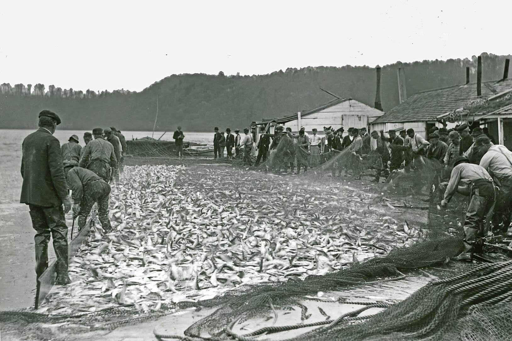
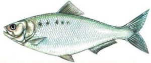
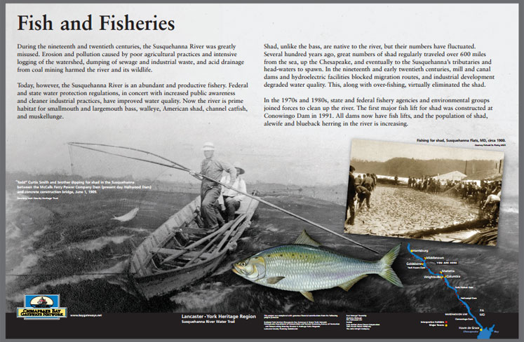
The river is home to many different species of fish including, smallmouth bass, walleye, catfish, musky, northern pike, American shad, and many other smaller panfish. The American Shad on the Susquehanna River has the most interesting and violent history.
Each year millions of migratory shad flooded the river from the Atlantic Ocean and surged upstream to reproduce in the Susquehanna’s North Branch at Cooperstown, NY and streams near Lock Haven. Men and women all along the river from the Chesapeake to New York state relied on the abundance of shad. Known as the “poor man’s salmon,” shad runs lasted for about a month. That brief season provided a burst of protein after a long, lean winter. It also caused disputes, battles, and violent riverfront confrontations for nearly a century.
Shad
Shad are a schooling ocean fish. When they migrate north into fresh water to spawn, buck shad (males) usually come first followed by roe shad (females). Roe shad are generally twice the size of buck shad. Temperature of the water decides when the journey begins. The water must be warmer than 40 degrees Fahrenheit. Shad runs happen all along the Atlantic Coast beginning in January in Georgia’s rivers while in the Northeast the runs are in May or June. However, you will not find a mature shad spawning in Georgia one year and Pennsylvania the next. They will return to their natal river to spawn. That means each river has a distinct spawning stock. On the Lower Susquehanna River, shad runs are normally between mid-April and June.
Schools of fish will follow the deep channels of the river as they travel north. When they reach their spawning location they will normally spawn between sunset and midnight. Shad prefer a gravel or sandy bottom in 4-8 feet of slow-moving water. They are sensitive to light so the brightness of a full moon on a clear night could delay the spawn. Spawning behavior includes a pairing of male and female shad. The pair will swim close together releasing their eggs and milt simultaneously. The shad will normally descend from the river back to the ocean shortly after spawning.
Shad eggs can take between 7 and 21 days to hatch depending on the water conditions. Larvae drift in the river until they mature into juveniles. Juveniles will stay in the river a few months feeding on zooplankton and insects. By late fall, most juvenile shad will migrate south of coastal waters. These juveniles will not return to the river for three to six years until they are ready to spawn.
America’s Founding Fish
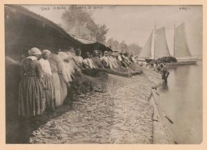
Native Americans used nets and weirs to catch shad. They would nail the fish to cedar planks and slow cook it over and open fire. In the course of cooking, the tiny shad bones dissolve. The cooking technique was passed to early English settlers and generations to come and is commonly called shad planking. European colonists also kept barrels of salted shad in their homes.
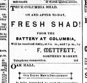
It was such a valuable staple that it was one of Colonial America’s first exports back to Great Britain and Europe. One Columbia man wrote ‘they were so plenty that five to ten dollars per hundred was esteemed a fair price.’ It was so important that access to shad fisheries could be used to settle bills and fathers willed islands and fishing spots to their sons.
Columbia was a hub for shad distribution. The fruits of the river were distributed not just in local markets but also hotels, inns, and restaurants. The Tremont Hotel in Columbia was famous for its planked shad dinners. A visitor from Pittsburg described the Columbia planked shad dinner:
Fresh from the Susquehanna, nailed to a smoking pine plank, broiled thereon before a hot fire, brought to the table on the wood on which it was cooked; steaming hot, brown and crisp on the outer surface; white, juicy and flaky just underneath and clear through, with an indescribably delicate flavor possessed by a shad cooked in no other way, served with crisp, green lettuce and Saratoga chips; served in a cool dining room looking out toward the broad bosom of the sun-kissed river; gentle zephyrs playing in and out of the open windows, a pleasant, jolly, brilliant company, full of jest and song and story-there is nothing under the blue skies that can equal it, save the except more of the same. It is a revelation. – Pittsburg Dispatch, May 13, 1889.
As early as 1700, the province of Pennsylvania had passed legislation relating to fishing access. The first law barred the construction of fish weirs that stretched from shore to shore. The law was not specifically aimed at protecting the fish populations on their migration, rather, it was intended to make fish equally available to everyone that lived along the waterways. In 1731, the Pennsylvania Assembly received a petition from Lancaster County residents. The Conestoga Creek had been dammed by Stephen Atkinson to for his fulling mill operation. The petition complained that the great quantities of fish once available up stream were stuck below the dam. Atkinson offered to leave a 20-foot-wide passage to allow fish to pass upstream. Before the Assembly took any action, locals took matters into their own hands and destroyed the dam.
Library of Congress
In 1761, the Pennsylvania Assembly would pass a series of laws for the preservation of fish in the Susquehanna. It called for weirs, racks, baskets, pounds, and similar devices erected in the river to be destroyed and prohibited building in future years. As seines and large fishing operations became popular in the nineteenth century, the farther north you were on the river the less fish you were likely to catch. In 1814, Pennsylvania northerners complained that fisherman in Columbia were ‘constantly scouring’ shad that most had no chance of making it farther upstream. The Pennsylvania Legislature divided the river into sections and staggered fishing days – though they never enforced it.
About 50 years later, public sentiment demanded the government intervene to protect the shad runs. Between 1825 and 1840 multiple dams had been built on the Susquehanna: one at Columbia and two more on West Branch and Juniata tributaries. The Columbia dam was completed in 1839 and although the state had legislation requiring approval of the engineering plans there was no fishway constructed. A fishway would not be added to the Columbia dam until 1866, so for over 25 years frustrated fisherman complained. Legislation edicts were ended when a proper government agency was created in 1866 and expanded in 1871 – it is now known the Pennsylvania Fish and Boat Commission.
Lancaster Daily Intelligencer, May 12, 1885
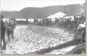
Each spring, newspapers announced the shad run had arrived as fisherman’s wagons loaded down with fresh fish rolled into towns. In 1882, the Lancaster Daily Intelligencer reported that fish dealers throughout the streets of the city doing “lively trade” selling Columbia shad for 25 to 65 cents a piece. Between 1831 and 1850, fisherman caught 41,000 metric tons of shad every year in the Chesapeake Bay region. That is equivalent to the weight of a humpback whale taken from the bay every year! As commercial fisheries expanded to answer the demand for shad and overfishing decreased the shad population, it is easy to see how a disagreement over shad could quickly turn violent.
Shad Wars
Violent outbursts over shad were common every spring from the mid-1700s through the Civil War. Weapons ranged from rocks to rifles – and allegedly a cannon – and their actions became locally referred to as the shad wars. Fishermen would fight over best fishing places, accesses to river islands, and mill dams restricting good fishing. Nearly all the confrontations were on the lower Susquehanna River – south of Columbia. There was a great number of islands to be used for fishing on this section. Islands could be bought and sold like any other private property and were highly desirable locations for good shad fishing.
In the 1850s, a series of incidents became known as the Great Safe Harbor Shad War. In the most heated incident, Columbia seine fishermen traveled down to Safe Harbor to destroy weirs, baskets and other ‘shad-killing contrivances’ in use. The Columbia invaders were met by men with rocks and boat poles as their weapons. It is said that the Columbians retreated under threat of fire from a Griffin cannon made at the nearby Safe Harbor Iron Works. The Safe Harbor men long denied using the cannon. At the end of the decade, six Columbia fishermen attempted to take a fishing island by force. It was claimed by residents of Washington Boro. After a physical exchange, the Columbia men returned to town and charged the Washington Boro men with causing a riot. The judge convicted the Boro men with assault and battery and fined them $5 each. (Columbia Spy, June 16, 1860)
In 1862, a group of anglers from Turkey Hill area were caught poaching shad on an island and fired upon a group of York county men who came to remove them from the island. In the exchange, the Turkey Hill men fired four shots, killing one York Countian and seriously wounding another. A court jury sent one of the Turkey Hill men to Eastern State Penitentiary for 11 ½ years for second-degree murder. (Columbia Spy, November 26, 1862)
Laws had also been passed to prohibit fishermen hauling in shad nets within a half-a-mile from any dam. At the Columbia dam, many locals were continuing to fish just south of the dam. In April 1880, five state fish wardens were sent to Columbia to break up the illegal fishing. The fish wardens were met on the river with distain and their boat was overturned. They managed to swim to the canal tow path and shore but were greeted by more locals carrying “black-jacks, empty bottles, and sections of rock. The wardens reached their hotel nearly more dead than alive, and the landlord locked them in their rooms where they could patch up their cracked heads and listen to the serenades of the fishers under their windows.” (Columbia Spy, May 1, 1880) In a state report later recounting the ongoing illegal fishing at Columbia, they noted that a half-dozen or more delinquents eventually were imprisoned and fined.
In an 1879 report form the Fish Commissioners, there were 48 fisheries in the 5 miles between Columbia and Turkey Hill. There were another 200 fisheries between Turkey Hill and Havre de Grace, Maryland. Over fishing had become a significant issue. The fish commission spent the next decade creating hatcheries along the lower Susquehanna to increase shad populations. They stocked the river with over ten million juvenile shad between 1889 – 1891. The real end to commercial shad fishing would come as a result of the hydroelectric dam construction at Conowingo, Holtwood, and Safe Harbor. Although fishways and stocking programs help boost shad populations, the shad runs of the nineteenth century will likely never return to the lower Susquehanna.
Gerstell, Richard. American Shad: A Three-hundred Year History in the Susquehanna River Basin. Pennsylvania, Pennsylvania State University Press, 1998.
River Roots is Susquehanna NHA’s blog series featuring history from York and Lancaster Counties that showcases the Susquehanna River’s historic, cultural, and natural resource contributions to our nation’s heritage.
This month SNHA is celebrating natural heritage by exploring the lower Susquehanna River’s connections to a network of key stopover sites along the Atlantic Flyway. The beneficial effects of the Susquehanna River’s connection to the flyway have played an important role in creating rich biodiversity and potentially shaped the foundations of early settlement and local culture.
The Conejohela Flats are part of a series of locations on the lower Susquehanna that offer respite for migratory birds. Some other sites include the Muddy Run Reservoir, Conowingo Reservoir, and the Susquehanna River at Safe Harbor. Each location’s unique attributes aid the birds during their stop along the flyway. These stopover sites continually draw large volumes and varieties of migrating birds through the Susquehanna River corridor biannually.
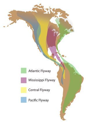
The Atlantic Flyway
A flyway is a route regularly used by large numbers of migrating birds and the Atlantic Flyway is one of four major flyways in North America. The other flyways include the Central, the Pacific and the Mississippi. The Atlantic Flyway is a major north-south flyway for migratory birds in North America. Stretching from the Arctic tundra of Baffin Island to the Caribbean, the Atlantic Flyway spans more than 3,000 miles. The route generally starts in Greenland, then follows the Atlantic coast of Canada, continuing south down the east coast of the United States, then to the tropical areas of South America and the Caribbean.
According to Audubon, about 500+ bird species use the Atlantic Flyway. Millions of songbirds, shorebirds, birds of prey, and waterfowl follow the flyway every fall and spring. The flyway is not limited to birds alone, the route is also used by butterflies, as well as some species of bats and dragonflies.
Migration can be triggered by a combination of changes in day length, temperatures, food supplies, and genetic predisposition. Spring migration occurs in a mass movement within the flyway. It takes place over a shorter period than the fall migration since birds are anxious to reach their breeding grounds. March through May, you can see flocks making their way north across the United States. The fall migration season is a drawn-out affair. The travelers begin heading south starting in August and lasting through October, but some waterfowl can procrastinate until December depending on weather conditions.
Migrating birds use a variety of methods to navigate the flyway. Topographical cues, such as coastlines, river courses, and mountain ranges, help to guide the flight. Typically, species in the Atlantic Flyway migrate farther, making stopover sites critical to their journey. Migrating birds rely on these sites to breed, feed or rest, particularly along the east coast of the United States. The Chesapeake Bay and Susquehanna River form the single largest watershed on the East Coast and provide a variety of important stopover sites. Each site plays a critical role in migratory birds’ survival.
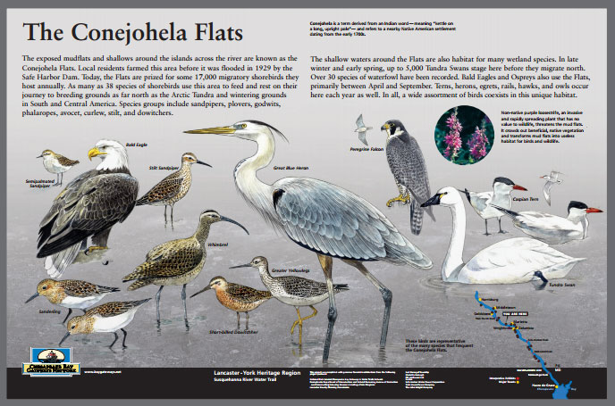
The Conejohela Flats Important Bird Area
The Conejohela Flats are a combination of low-lying brushy islands and adjacent mud flats on the Susquehanna River in Lancaster County about three miles south of Columbia and Wrightsville, located just offshore from Washington Boro within the Susquehanna NHA. The flats are highly important to migratory shorebirds, providing essential habitat and resources.
The Conejohela Flats stopover site is a Pennsylvania Game Commission designated propagation area for numerous wetland species and waterfowl. Migrating birds use the river for feeding and the flats for resting. The flats are one of only a handful of dependable sites in Pennsylvania for large numbers and variety of shorebirds. A total of 38 shorebird species has been recorded at this site. The Conejohela Flats hosts up to 17,000+/- migratory shorebirds during migration.
The Conejohela Flats have been named an Audubon Important Bird Area. Important Bird Areas are distinct areas that provide essential habitat for one or more species of birds in breeding, wintering, or migration. The Conejohela Flats are also listed on the Natural Heritage Area inventory. Natural Heritage Areas are locations of rare, threatened, and endangered species and the highest quality natural areas in Pennsylvania. Information is gathered at these areas with the purpose of providing current, reliable conservation information on biological diversity, protected lands, streams, and other natural resources for planning purposes.
The Conejohela Flats’ connection to the flyway reminds us that the migrating birds visiting these sites connect the lower Susquehanna with the rest of the world, and that we have a shared responsibility to work for their conservation. The Atlantic Flyway is home to a wide variety of ecosystems all reliant on each other.
The Atlantic is the most densely populated of the four flyways and many waterfowl habitats in this region are threatened by development and urban sprawl. Many stopover sites face hardships despite conservation efforts.
The Conejohela Flats are alluvial islands that develop from the forces of erosion and deposition and the building up of large amounts of sediment which alters their shape and size. Major floods from severe weather events can dramatically change islands. Ice during the winter devastatingly carves out large chunks of land and soil altering the landscape. The dredging of river channels, construction of dams, pollution and erosion of soil caused by poor agricultural practices, intensive logging of the watershed, and acid drainage from coal mining has harmed natural areas such as the Conejohela Flats and on a greater scale the health of the Susquehanna River and the Chesapeake Bay.
Efforts have been made in recent years to restore the health of the river and Bay, but much work remains to be done. The operators of Safe Harbor Dam are required by their Federal Energy Regulatory Commission license agreement to not raise the water level of Lake Clarke above a certain set amount so that a percentage of mud flats are exposed from April through October during the shorebird migration period.
Contributions to Cultural Heritage
One of the great things about taking a closer look at our connection to the flyway is that it leads us to think about our own heritage, and how it fits in with larger patterns in history. The term Conejohela is derived from a Native American word meaning “kettle on a long, upright pole.” The Susquehannock were the last known native group to live in this area along the river near present-day Washington Boro. The many islands and rocks were used for hunting and fishing. Dugout canoes aided in hunting and trade on the river.
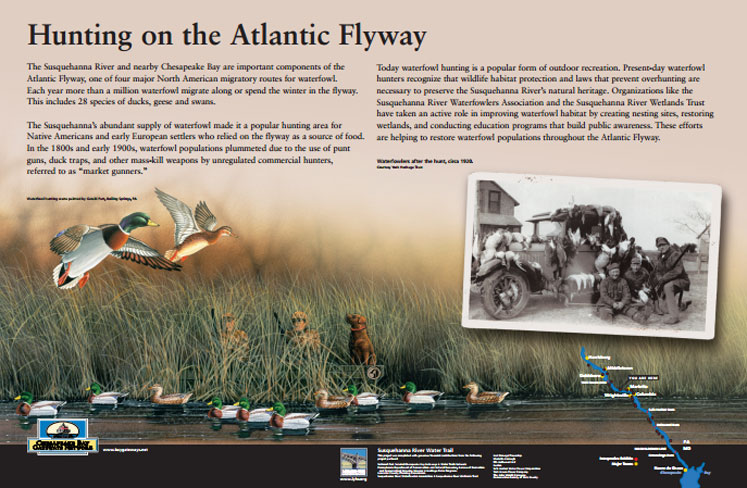
The geographic location and natural resources made the Susquehanna an ideal location for early settlement. Atlantic Flyway stopover sites like the Conejohela Flats provided greater species diversity, on the river and along its shores. The Atlantic Flyway’s biannual supply of migrating waterfowl to the lower Susquehanna, made it a popular hunting area for Native Americans and European settlers.
The Susquehanna River is not just a major migratory corridor for ducks and geese, it is among the places where modern waterfowl hunting began. Waterfowl have been hunted for food, down, and feathers since prehistoric times. A more modern version of duck hunting began on the east coast during the 1600’s, as European settlers began to arrive. In England, hunting was generally the pursuit of game on land with hounds. Settlers brought primitive firearms and hunted waterfowl with great zeal in the new world. Native Americans honed their skills of luring waterfowl into bow range with handmade decoys. The Native American’s technique of hunting on the water combined with the settler’s powerful firearms yielded a new way of waterfowl hunting on the Susquehanna.
The Susquehanna River and the Conejohela Flats are still a popular and bountiful waterfowl hunting area today. Waterfowl hunting traditions on the Susquehanna River connect outdoorsman with all those who have done so in its rich history: direct ancestors; rough and ragged market hunters; decoy carvers past and present, even the Susquehannock Indians who once canoed the river’s banks.
For generations, the flats provided additional opportunities in the spring and fall for protein and sustenance. The Atlantic Flyway’s consistent migration pattern and abundance of waterfowl facilitated human settlements to grow and thrive along the shores.
Learn More
Learn about the birds that use the Conejohela Flats. Click on a bird to go directly to their Audubon page. Check out the songs and calls section that has audio files of each bird!
Sit back and enjoy the show. A high diversity and abundance of species to enjoy makes the Conejohela Flats among the top-ranking areas in Pennsylvania for bird watching. The flats can be viewed from shore with a pair of binoculars. You’ll likely see many birds soring overhead during your visit.
Discover and explore other local stopover sites on the Atlantic Flyway in this LancasterOnline article.
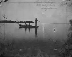
To learn more about outdoor heritage and traditions on the Susquehanna River view “A Look Back at Hunting, Fishing, and Trapping on the Susquehanna River” exhibit, on display at the Columbia Crossing River Trail Center through August 2021. https://susqnha.org/hunting-fishing-trapping/
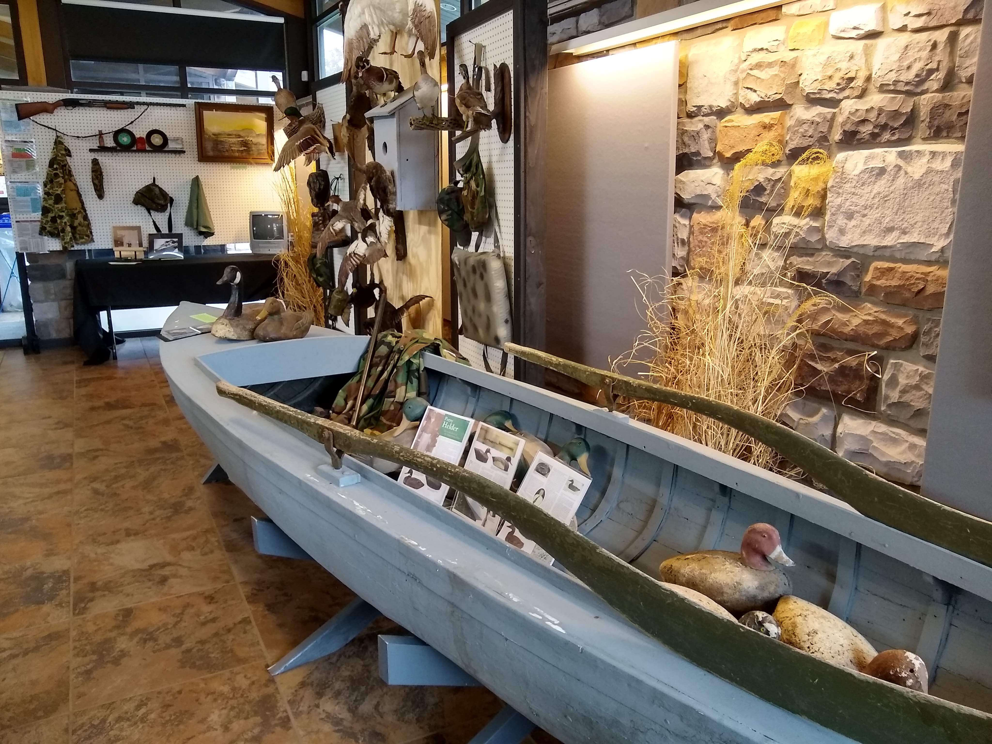
A Look Back at Hunting, Fishing, & Trapping on the Susquehanna River
Susquehanna National Heritage Area and local historian Lynn Smoker present A Look Back at Hunting, Fishing & Trapping on the Susquehanna River, now on display at Columbia Crossing River Trails Center. The exhibit provides a glimpse into the techniques and tools for capturing wildlife on the Lower Susquehanna River. Smoker has spent years enjoying the river as an avid hunter and fisherman and as a devoted collector of Susquehanna River artifacts. Visitors to this brand-new exhibit will see original and unique tools and artifacts related to hunting, fishing, and trapping, including a locally built duck boat from 1927, along with an array of mounted waterfowl, fish, and furbearing mammals.
Hunting has played a rich and prominent role in American culture. For centuries, hunting was required for survival. Native Americans utilized the animals in and along the river not just to feed their families but for heat, clothing, and shelter. Pioneers settled the region and harvested game as readily as they planted crops. Although the Lower Susquehanna River region transitioned to farming livestock, the hunting tradition stayed ingrained in the culture. These traditions continue to connect people to the raw beauty of the river and all the resources it provides.
The Susquehanna River has remained a sanctuary for a variety of wildlife as it is naturally non-navigable to industrial vessels. Prior to the construction of hydroelectric dams, the Susquehanna River had a rush of migratory fish each spring. Shad swelled up the river sometimes looking like waves in the water. Locals plucked them from the river by the hundreds. Learn about the shad runs, ice fishing, and fishing techniques of generations past.
The Susquehanna River is an integral part of the Atlantic Flyway, one of four major North American migratory routes for waterfowl. Pennsylvania hunters annually take good numbers of mallards, wood ducks, and black ducks. Many also experience good action for buffleheads, bluebills, ring-necks, green-winged teal, Canada goose, and snow geese. Hunters typically decoy, blind hunt, or pass-shoot from open water or on nearby agricultural fields. Learn about the unique design of the Susquehanna River waterfowl decoys and how they have become a celebrated American folk-art tradition.
Furbearing animals like beaver, river otter, marten, and mink were essential to Native Americans especially in trade with Europeans. See these furs and learn about how they were trapped and traded by the Susquehannock, the only native tribe to trade with all four major European colonialists (Dutch, Swede, English and French). For over two centuries, beaver fur was especially desirable for men’s hats. Trapping continues to be a riverfront tradition but is highly regulated as a wildlife management strategy. Modern techniques, sanctioned seasons, and permitting have contributed to the repopulation of beaver and river otter along the Susquehanna River.
The exhibit also explores hunting for bullfrogs and snapper turtle. Hunters utilized kerosene lights and gigs to bag frogs in the darkness. Snappers were more difficult and dangerous – with a bite that could remove a human finger. Antique snapper traps, gigs, and even recipes are on display.
A Look Back at Hunting, Fishing & Trapping on the Susquehanna River will be on display at Columbia Crossing River Trails Center through August 2021. A series of outdoor, social-distanced lectures are being planned for the spring/summer 2021 to more deeply explore the history surrounding these traditions. Visitors are welcome to come during operating hours: 10 am – 4 pm Tuesday through Saturday and 12 pm – 4 pm on Sundays. Exhibit is free but donations are appreciated.
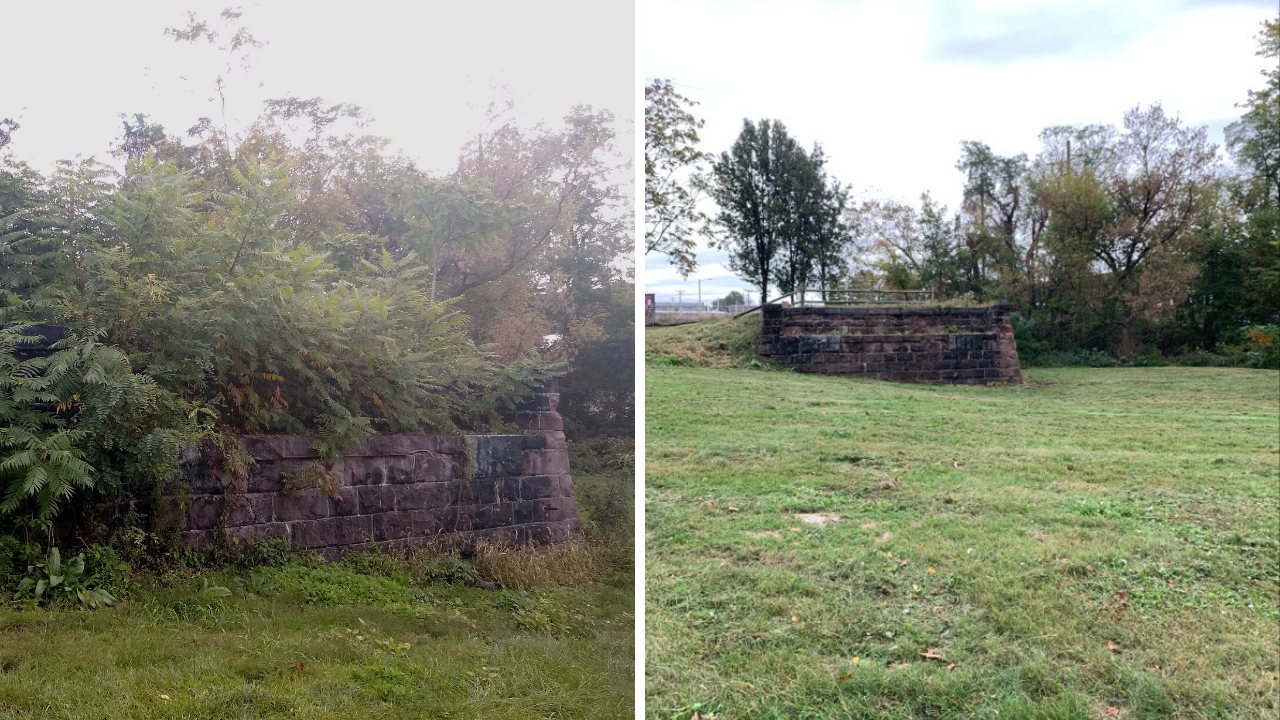
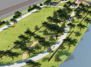
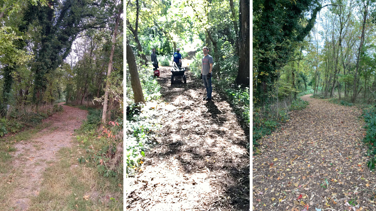
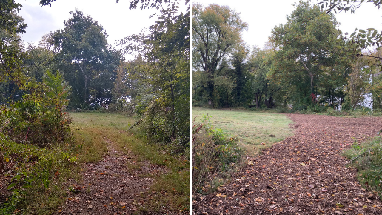
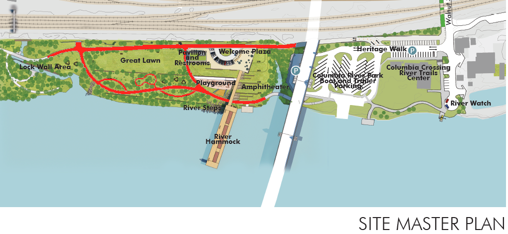
A crew of four amazing young adults from the Pennsylvania Outdoor Corps worked tirelessly in mid-October at Columbia River Park. The Park Expansion Area north of the Veterans Memorial Bridge has been inaccessible and overgrown for years. The area is partially forested and partially meadow. The area is also home to two land piers from the bridge that was burned during the Civil War. In 2019, a park master plan project created designs for the 11-acre expansion area. Amenities like a natural amphitheater, nature playground, pavilion, canal restoration, and loop trails along the river. Many of these projects will take long-term planning and heavy construction. Susquehanna NHA and Columbia River Park Advisory Committee sought inexpensive ways to provide more immediate access so they partnered with Pennsylvania Outdoor Corps.
Pennsylvania Department of Conservation and Natural Resources has a Public Partnership Program that provides municipalities and other non-profits the opportunity to partner with the Outdoor Corps to undertake recreation and conservation projects on non-DCNR public lands on a cost share basis. Crews can do a variety of projects from improving land, trails, and playgrounds to improving waterways and riparian buffers. At Columbia River Park, the crew worked to clear invasive species, extend the loop trail to the river, repair split-rail fence, and lay a trail surface.
The cost of this project was entirely funded by private donations. On behalf of Susquehanna NHA and Columbia River Park Advisory Committee we sincerely thank the Columbia Park Rangers, Mountz & Kreiser, Columbia’s Foresters of America, and all those that donated online to this project. This would not have been possible without the generosity of each donor.
Invasive Species Removal
Japanese knotweed, tree-of-heaven, and other invasive species had been growing unchecked in the area. Spotted lanternflies were covering many of the tree-of-heavens so removal was crucial. Removing these species from the forested area is vital to protecting the native biodiversity and habitat.
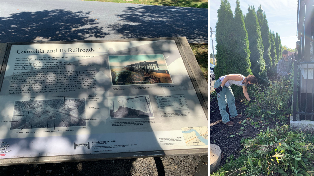
Most of the invasive species had spread along the split rail fence and the stone piers. These stone piers are important historical structures that help Susquehanna NHA and others tell many cultural significant stories. From the Civil War burning of the bridge to the Underground Railroad heritage, uncovering and preserving the piers allows for more heritage exploration.
Creating the Trail
The River Walk was added to the master plan design to provide a walkway parallel the water from the top of the riverbank. Spectacular sunsets and unique bridge perspectives can be seen along the walkway. In early spring 2020, the Columbia Borough Public Works Department cut that path through the woods. Columbia Crossing Director, Hope Byers, utilized a GIS mapping software to overlay the master plan design over the existing park. Stakes were placed exactly where the ‘River Walk’ is shown on the master plan.
Rendering of River Walk from Master Plan
The 12′ wide trail had an uneven dirt surface that would have quickly become overgrown without a surface. The Outdoor Corps pushed back overgrowth, removed invasive plants, downed trees, and litter throughout the wooded space to prepare the area. The trail surface was a woody mulch provided by the Columbia Borough Public Works Department and was created by grinding the woody waste from residents. There was enough woody mulch to continue the trail passed the stone pier and down to the waterfront by the existing outfall. Four dump truck loads of mulch were spread along the trail to create a welcoming, even experience.
Park Improvements
The crew had a few hours between cleaning up the trail and the first delivery of the mulch and offered to do any small projects around the Columbia River Park. They painted and stained posts of kiosks and signs in the park. They spray painted bicycle stencil on the NW River Trail to help guide riders safely along Route 441. They cleaned out the flower beds and prepared them for winter. They also scrubbed all the mold off the interpretative panels in the park.
Amazing work by a great crew of dedicated, up-and-coming recreation professionals. We are thankful for their hard work and donor’s hard earned dollars. Together they have made Columbia River Park a greener and more interesting place to visit. We invite all of you to visit Columbia River Park and take a stroll through the expansion area. It is accessible by walking behind Chiques Rock Outfitters outpost under the Veterans Memorial Bridge.
As local school districts planned for a very different school year, they faced some unexpected and unprecedented challenges. Columbia Borough School District started its Back-to-School Supply Drive asking for things they never needed before including reusable water bottles. Columbia Borough School District had retrofitted all the water fountains to be water filling stations. Removing the fountains would reduce the chance of spreading COVID-19 and the new fillers can also instill a healthy habit in Columbia’s youth.
As a member of the Superintendent Advisory Group, Hope Byers heard the school district’s call for reusable water bottles and knew Susquehanna National Heritage Area (SNHA) could fulfill the need. As part of managing Columbia Crossing, Hope works with the local community to engage youth in the river’s important cultural and natural assets and encourage good stewardship. COVID-19 had upended the opportunity for spring field trips and fall canoeing excursions.
“We have had to shift so much of our programs and activities to digital, self-guided initiatives that reusable water bottles sounded like a great opportunity to do that again. We couldn’t bring students to the river to engage, explore, and experience its wonders but we can remind them of its importance every day” says Hope Byers.
Hope Byers immediately reached out to SNHA’s long-time partner Lancaster County Solid Waste Authority (LCSWMA) about the project – knowing they would find this unique challenge intriguing. LCSWMA has committed to enhancing the recreational opportunities and quality of life in areas where its facilities are located. They have two such facilities along the Susquehanna River in Lancaster County: the Lancaster Waste-to-Energy Facility in Bainbridge that combusts waste to make electricity for our community and the Frey Farm Landfill in Manor Township. LCSWMA has made a proactive commitment to the river and its assets for over a decade.
“LCSWMA believes in the importance of being a community partner—both in protecting the environment and public health, but also investing back into the places we serve” says Bob Zorbaugh, LCSWMA’s CEO. “This is needed now, more than ever.”
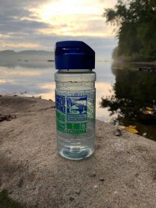
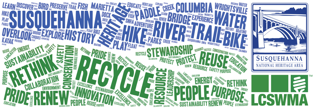
Providing reusable bottles to the student at Columbia Borough School District fulfilled many goals for SNHA and LCSWMA. First, to encourage reuse and recycling. They chose a 100% Post-Consumer Recycled Plastic Bottle, which helps support the entire recycling lifecycle. The chosen bottles were also made in the United States and come with a sip n’ pour lid with an easy carry handle.
Second, the partners desired the messaging to reflect how the Susquehanna River brings a wonderful synergy to our community. The bottle design uses a word-cluster of blue words flowing by green shoreline. All the blue words highlight the river’s assets and opportunities including trail, bridge, paddle, preserve, overlook, history, and explore. The green shoreline are ways in which LCSWMA (and all of us) can protect and care for the Susquehanna and its surrounding landscapes, including recycling, conservation, stewardship, reuse, sustainability, and collaboration.
Superintendent Tom Strickler said “Columbia Borough School District is very appreciative of SNHA/LCSWMA donation of water bottles for our students. Demonstrating to students the reuse of plastic in a positive manner is an example to students to recycle. Also, because of the COVID pandemic, students need bottles these bottles to access water fountains in each school building. Another very positive example of the positive collaboration between business organizations and Columbia School District.”
Five-hundred bottles were provided to the Columbia Borough School District and distributed to students. Additional bottles are available for purchase from Susquehanna NHA at Columbia Crossing River Trails Center. Pick up a bottle for yourself or to give as a gift. It’s a great way to show your love for the river and your commitment to care for it. All proceeds from reusable water bottles support Columbia Crossing’s educational initiatives. Visit the Center at 41 Walnut Street, Columbia, PA on Tuesdays – Saturdays 10 am to 4 pm or Sundays 12 pm to 4 pm.
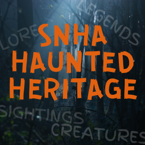
With Albatwitch Day and Halloween right around the corner, SNHA has put together a new map of our favorite haunted places, legends, and strange histories. Using local resources like authors Rick Fisher and Scott Butcher, the map pinpoints strange happenings, creature sightings, and wild tragedies. This map is just in time for spooky season and is perfect for those who want to learn more about things that go bump in the night in the Susquehanna National Heritage Area. The descriptions and stories are chilling, involving terrifying creatures, and tales of the supernatural and paranormal experiences, combining both the familiar and the bizarre.
Paranormal Experiences
Use the map to explore all the Orange Pinpoints for information on local haunted sites. From cold spots to random spirits crying, there’s no shortage of haunted spots in these old river towns. Don’t miss these haunted spots on the map: Haldeman Mansion, Shenk’s Ferry Tunnel, and the Shock’s Graveyard.
Folklore & Legends
Have you heard any local legends? They often evoke strong emotional reactions such as horror, shock, revulsion and humor. The retelling of legends over time ensures that they become part of public record and explains why they are so well known. The strange thing is that notoriety and disproof do not prevent legends from resurfacing generation after generation. Enjoy some of our favorite local legends indicated by the Black Pinpoints on the map. Be sure to read up on the Albatwitch and Lover’s Leap Legend.
Tragedies & Odd History
Looking for just the facts? Check out all the Purple Pinpoints on the map for some strange but true stories from the river region. Learn about Marietta’s Gilliland Laboratories and Brownie, the horse that provided enough blood for 1 million tetanus vaccines. If you prefer a good true crime story, check out the Hex Hollow Murders and their connection to the Marietta Witch. Don’t forget to check out the tragedies like the Chickies trolley accident that killed six people or the Columbia opera house fire of 1947.
Columbia River Park Advisory Committee (CRPAC) has been working to expand River Park beyond the Veteran’s Memorial Bridge. A Master Site Plan for the 10-acre area was created over the course of an 11-month time period and utilized extensive and on-going public engagement throughout the process. In total, more than 1,200 persons participated in the effort. The most popular ideas for historic, cultural, environmental and entertainment features included bridge pier restoration, canal restoration, live outdoor music/performance programming, picnicking, stream restoration and native plant gardens. The final design is visionary riverfront development plan that showcases the convergence of people and nature over thousands of years in a memorable and daring design.
Although this visionary design will take years to complete, the CRPAC is seeking inexpensive and unique ways to make the area more user friendly. Cutting the trail paths created in the design and removing all the invasive species from the forested areas would be a great start. The Pennsylvania Outdoor Corps is a crew that can quickly and professionally complete this project.They have a Public Partnership Program that provides municipalities and other non-profits the opportunity to partner with the Corps to undertake recreation and conservation projects on non-DCNR public lands on a cost share basis.
CRPAC is seeking $3,000 in cost-share needed to pay PA Outdoor Corps to complete this project. Part of the project has been funded by the Columbia Park Rangers as well as Mountz and Kreiser and the Foresters of America. We are so grateful for their support but need your help to make it to $3,000 total.
PROJECT DETAILS:
Improve trail paths highlighted in red
10’ – 12’ wide on the primary loop and 6’ – 8’ wide on the auxiliary loops
Level the trail surface, add trail surface material
Remove invasive species from forest area between PA 462 Bridge & Lock Wall Area
We hope you will consider donating to this small but important project!


 Tundra Swan
 Great Blue Heron
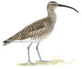 Whimbrel
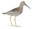 Stilt Sandpiper
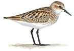 Semipalmated Sandpiper
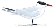 Caspian Tern
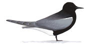 Black Tern
 Greater Yellowlegs