RiverRoots: Rattlesnake Colonel: Thomas Cresap, An American Paradox
River Roots is Susquehanna NHA’s blog series featuring history from York and Lancaster Counties that showcases the Susquehanna River’s historic, cultural, and natural resource contributions to our nation’s heritage.
Susquehanna NHA is pleased to introduce guest blog writer, Michael Maloney. He is a native of York County, Pennsylvania, and recently published a biography of Thomas Cresap.
RiverRoots Heritage Blog
An American Paradox
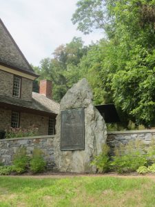
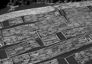
Four miles south of Wrightsville on Long Level Road, a bronze tablet at the Zimmerman Center for Heritage and a nearby roadside marker commemorate Marylander Thomas Cresap and the site of Cresap’s Fort, where Cresap lived before having his cabin burned to the ground and being arrested by Pennsylvania authorities nearly 300 years ago.
However, the historical markers only hint at the much larger story of a seven-year conflict, sometimes called “Cresap’s War,” where Pennsylvania and Maryland squared off against each other for ownership of a thirty-mile wide swatch of land along the southern border of Pennsylvania. Although the hostilities may not adhere to the modern perception of a war, both colonies mustered militia, planned and carried out attacks, destroyed property, displaced settlers, and took prisoners. To those living there, it most likely felt like a war zone, as they were under constant threat of attack and fear of losing their homes. Several lives were lost and many more ordinary citizens had their lives disrupted.
If you ask almost anyone living in York or Lancaster County today if they know who Thomas Cresap was, most have never heard of him and only a few might mention he had something to do with Maryland. The real answer is complicated and would have depended on who, and when, you asked the question.
In the summer of 1736, if you asked a room of German and Scotch-Irish settlers gathered in John Wright’s ferry house in today’s Wrightsville, you would have been met with a chorus of boos and hisses. Everyone knew the “Maryland Monster” who had been terrorizing Pennsylvania settlers on the west side of the Susquehanna River for the previous five years. However, if you happened to encounter a band of Six Nations warriors passing by Cresap’s trading post at Oldtown in Western Maryland fifteen years later, they knew Thomas Cresap as “Big Spoon,” their friend who always seemed to have a big pot of food ready. In 1755, if you mentioned Thomas Cresap to a British army officer during the French and Indian War, you would have heard yet a third opinion. The officer would not have been impressed with the “Rattlesnake Colonel,” a lowly Colonial militia officer who often mishandled provisions for General Braddock’s troops. At the beginning of the American Revolution, if you asked the same question to anyone in Frederick County, Maryland, you would have been greeted with enthusiastic cheers and huzzahs for Thomas Cresap, who they considered a frontier hero.
Thomas Cresap was all those things and so much more. His professional resume would have included extensive experience as a frontiersman, Indian trader, soldier, ferryman, land speculator, farmer, trailblazer, surveyor, politician, patriot, husband, and father. Had he applied for the job of a Colonial man’s man, he would have been hired on the spot.
Cresap’s War
Cresap’s War had its roots fifty years before he arrived when William Penn received his Colonial charter in 1681, which defined Pennsylvania’s southern border as the fortieth parallel of north latitude. At first glance, this seems to correspond nicely with Cecil Calvert’s charter of 1632, which specified the same fortieth parallel as Maryland’s northern border. However, Penn’s charter was based on grossly inaccurate maps and he erroneously assumed his new colony extended as far south as the Chesapeake Bay.
When commissioners from both colonies met the following year and took their first astronomical measurement in New Castle, now in Delaware, Penn was shocked that the fortieth parallel lay much farther north, placing Pennsylvania’s proposed capital city of Philadelphia within the bounds of Maryland. For the next eight decades, the Penn family and five generations of Calverts attempted to settle the dispute themselves but the controversy was not permanently resolved until Charles Mason and Jerimiah Dixon completed their survey of the Maryland and Pennsylvania border.
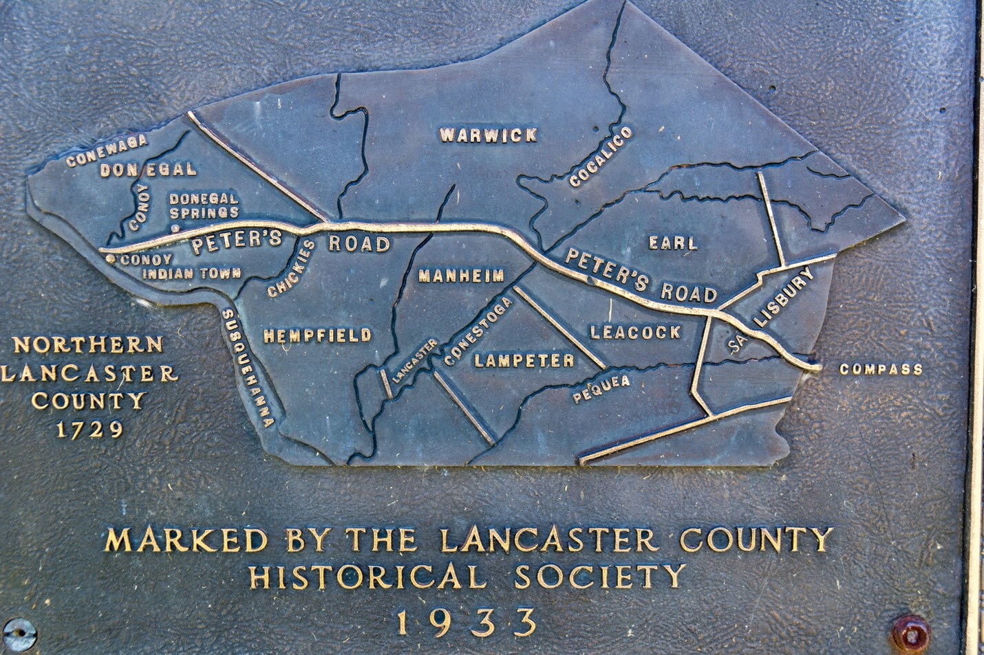
In 1730, Maryland began issuing generous land grants on the west side of the Susquehanna River, as far north as today’s Wrightsville and near the actual fortieth parallel, which crosses York County at the Highpoint Scenic Vista & Recreation Area. At the time, the area was still largely uninhabited due to Pennsylvania’s policy of prohibiting settlements on land they had not yet purchased from the Native Americans. Maryland had no such policy, and by establishing tax-paying settlers, they were the first to stake a claim to the disputed area.
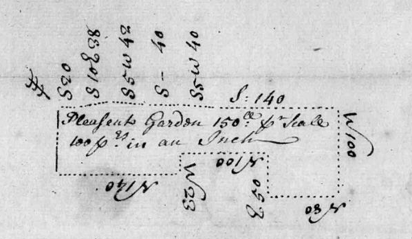
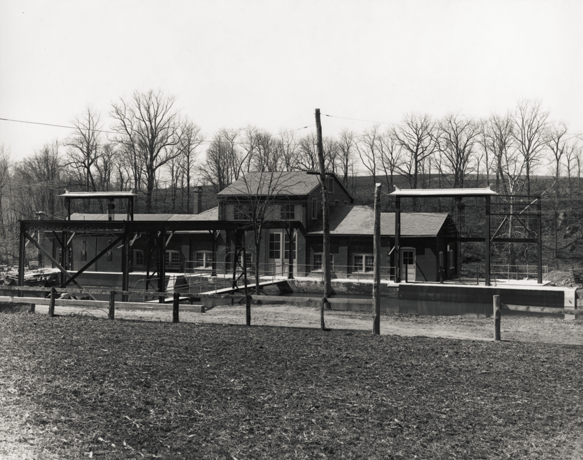
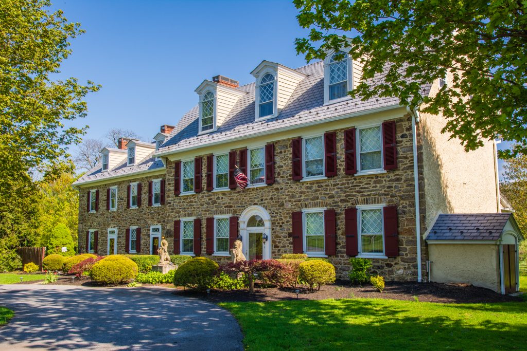
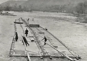
The following year, Thomas Cresap received a Maryland land grant called Pleasant Garden, along the bank of the river below a former Native American village. Although the exact location of his cabin, often called “Cresap’s Fort,” was lost to history when the Susquehanna and Tidewater Canal was constructed one hundred years after Cresap left the area, the Zimmerman Center for Heritage on Long Level Road, built by John Meyer around 1740, is located on Cresap’s Pleasant Garden tract.
Shortly after Cresap settled at Pleasant Garden with his wife Hannah and their two children, he was appointed as a Baltimore County Justice, received a license to operate a ferry across the Susquehanna at Blue Rock, obtained a captain’s commission in the Maryland militia, and was encouraged to recruit other Maryland settlers to the area. He immediately clashed with Pennsylvania authorities in Lancaster County, settlers on the west side of the river, and the local Conestoga tribe, who still used the land around their former village for hunting and gathering food.
The next seven years were a continual cycle of retaliatory arrests, armed assaults, property destruction, and harassment of settlers, with both Maryland and Pennsylvania flexing their jurisdictional muscles in an attempt to control the contested area. On several occasions, Thomas Cresap and the Maryland militia confronted volunteers from Lancaster County, but backed down before any serious violence erupted. In 1734, during one of the many failed attempts to capture Cresap, a vigilante posse attacked his cabin and in the skirmish he shot and killed a Pennsylvanian named Knowles Daunt.
An important part of Maryland’s strategy was to persuade the German settlers on the west side of the river to identify as Marylanders. Although a few held provisional land patents from Pennsylvania, called Blunston Licenses, most were squatters who had settled without permission. In exchange for paying taxes to Maryland, Cresap promised them deeds for their properties, which he never delivered. However, after Pennsylvania purchased the land west of the river from the Six Nations in 1736, the Germans decided to defect to Pennsylvania, hoping to gain legal ownership of their property and liberate themselves from Cresap’s strong-arm tactics. Maryland authorities were infuriated and issued arrest warrants for sixty settlers, triggering renewed violence against the German settlers.
Pennsylvania finally had enough and ordered Cresap’s arrest. In late November 1736, Sheriff Samuel Smith and a large posse from Lancaster County surrounded Cresap’s cabin. After a day-long siege and exchanges of gunfire and insults, his cabin was set afire. As Cresap, his family, and his allies escaped from the flames, one of his indentured servants, Loughlin Malone, was killed by the sheriff’s men. The Maryland Monster was finally captured and taken to jail in Philadelphia, where he sarcastically commented that it was the one of the prettiest cities in Maryland. He remained locked up until early 1738, when King George II ordered that all hostilities should cease, prisoners on both sides should be released, and the Maryland and Pennsylvania border would be located on an east-west line fifteen miles south of Philadelphia.
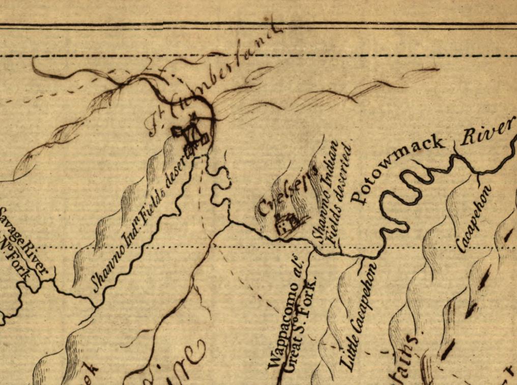
After Cresap was released from jail and returned home, he realized he had nothing left to fight for since Pleasant Garden was now officially outside the bounds of Maryland. Not wanting to be a subject of Pennsylvania, Cresap moved his family to the frontier of Western Maryland, briefly settling near the future town of Hagerstown, Maryland, before relocating farther west to an abandoned Shawnee Village at today’s Oldtown, Maryland. Cresap soon established a trading post and became a well-known figure on the frontier, providing a place of refuge for settlers in time of war. He earned himself the nickname Big Spoon by supplying provisions to the Native Americans passing through Oldtown.
American Frontier
When the French and Indian War spread across Western Maryland, Colonel Cresap was in the middle of the action. He was placed in charge of transporting the prisoners taken by George Washington in the opening shot of the war at Jumonville Glen, and the following year, Cresap and a Delaware Indian named Nemacolin blazed a trail from Western Maryland to today’s Pittsburgh for General Braddock’s 1755 expedition to capture Fort Duquesne. The British officers who camped at Oldtown were not particularly impressed with Cresap, especially after he supplied spoiled food to the troops, and referred to him as a Rattlesnake Colonel, a rank which they felt could be earned by anyone in the colonies for simply killing a rattlesnake.
Cresap amassed thousands of acres of land in Western Maryland and was a founding member of the Ohio Company of Virginia, a land speculation company that was determined to acquire and settle a large land grant in the Ohio Valley, in today’s West Virginia and southwestern Pennsylvania. In 1757, he entered politics and served as a representative in the Lower House of Maryland for more than a decade. Despite being in his early 80’s when the Revolutionary War broke out, Cresap was an active member in the Frederick County Committee of Observation, a local organization designed to enforce boycotts of British goods, solicit funds for arms and ammunition, and identify British loyalists. An ardent patriot, Cresap formed a local Sons of Liberty Chapter in Frederick, Maryland.
Thomas Cresap died in 1787 at the age of ninety-three. Whether his legacy is viewed as positive or negative depends largely on perspective. Although there is no doubt his influence in the development of the Ohio Valley was significant, his contributions remain a largely misunderstood side note in American history, often overshadowed by his controversial actions over five decades to redefine the borders of Maryland, Pennsylvania, and Virginia. Few individuals did more, over such a long period of time, to further Colonial America’s westward expansion. History has shown that Cresap’s fervent commitment to the interests of Maryland was a product of the narrow-minded sectionalist views of his time, emphasizing his loyalty to one colony rather than the country as a whole. Whatever his motives, he remained true to his convictions, whether in support of Maryland, Great Britain, or America, making him both famous and infamous – a true American paradox.
Author Information
Michael Maloney is a native of York County, Pennsylvania, and currently resides with his wife in Red Lion. Now retired, he was the Director of Technical Services for Lifetime Brands (the former Pfaltzgraff Company) since 2005. Although he grew up in York, both his parents and many of his relatives are from Marietta and Mount Joy in Lancaster County. Consequently, he spent many summers along the Susquehanna River at his grandparent’s house, exploring the river shore and the surrounding hills.
After learning of a gravesite behind the Accomac Inn, he was curious to research the Accomac ferry crossing, the town of Marietta, and the murder of Emily Myers at the hand of John Coyle, Jr. on Decoration Day, 1881. His love of local history led him to write his first book, Across the River, Murder at Accomac, released in 2012 for the 200th anniversary of the establishment of the borough of Marietta.
His second non-fiction book, Rattlesnake Colonel Thomas Cresap – An American Paradox, is a biography of Thomas Cresap’s contradictory and often controversial life. Cresap’s life experiences in Pennsylvania and Western Maryland are used to narrate the complicated political and military conflicts of eighteenth-century Colonial America in a comprehensive yet understandable way. For more information, presentation schedule, where to buy, and bonus content, visit michaelmaloneybooks.com!