In an inspiring display of teamwork and dedication, students from the Pennsylvania Outdoor Corps have made lasting improvements to both the Mifflin Farm and the Zimmerman Center for Heritage this summer—laying the groundwork, quite literally, for increased visitor access and enjoyment.
During the week of July 14th – 19th, six high school students and their leaders blazed the first official walking trail at the Mifflin Farm. The newly completed “Pond Loop” is a .4-mile grass trail beginning at the historic Mifflin House and winding to a serene man-made pond at the heart of the property. This scenic loop invites visitors to take glimpses of wildlife, including fish, birds, and deer, while soaking in the natural beauty and heritage of this important landscape.
While plans for over 4 miles of future trails are in development, this loop marks a major milestone in opening the interior of the Susquehanna National Heritage Area’s newest park to the public—just months after its launch.
More recently, during the week of August 4th – 8th, another crew from the Pennsylvania Outdoor Corps turned their energy to the Zimmerman Center for Heritage. There, they focused on clearing and refreshing the walking paths around the visitor center, and to Native Lands County Park including the nature space, restoring the site’s natural appeal and improving access for all who come to explore the area’s rich river history and native landscapes.
We offer our deepest thanks to these hardworking students and their leaders. Their contribution not only enhances SNHA visitor sites, it helps connect people with nature, history, and each other.
Get Ready for an Unforgettable Summer on the Susquehanna!
Plan your summer getaway and experience the magic of being on the water, spotting local wildlife, and hearing captivating stories of the river’s history aboard the Chief Uncas. Tickets are now available to purchase for 1-hour guided boat tours July – Labor Day weekend. SNHA will welcome guests aboard the Chief Uncas, a historic 112-year-old electric powered boat for tours on the Lake Clarke June through October.
Boat Tours will embark from the dock at SNHA’s Zimmerman Center for Heritage, located at 1706 Long Level Road, Wrightsville, PA. Tours will be offered Thursday – Sunday. These guided tours offer passengers the chance to explore the Susquehanna aboard a 112-year-old electric boat as tour guides share stories of the river’s rich history and heritage. Tickets are available to purchase online.
River Discovery Boat Tours: SNHA guides up to 22 passengers on a 1-hour guided tour of the Susquehanna. On SNHA’s signature tour, passengers will be able to take in the spectacular river views and learn about the river’s cultural and natural heritage. Tickets are $24 for adults and $12 for youth (ages 5 to 17). If you are 65 or older take advantage of the senior discount by purchasing a senior ticket for $22. Children under 5 years old are $5. Guests can personalize their experience aboard the Chief Uncas and explore the Susquehanna on one of SNHA’s specialty themed tours.
Themed Boat Tours: Specialty themed boat tours are offered throughout the tour season and highlight interesting heritage stories of the river’s Civil War, Native American, and Haunted Heritage. Tickets are $24 for adults and $12 for youth (ages 5 to 17). If you are 65 or older take advantage of the senior discount by purchasing a senior ticket for $22. Children under 5 years old are $5.
About the Chief Uncas The Chief Uncas was built in 1912 for Adolphus Busch, co-founder of the famous American beer company, to enjoy cruises at his summer estate on Otsego Lake in Cooperstown, NY – the headwaters of the Susquehanna River. SNHA purchased the Chief Uncas in 2021 and transported the boat to Pennsylvania. To learn more about the history of the Chief Uncas, read SNHA’s history brochure.
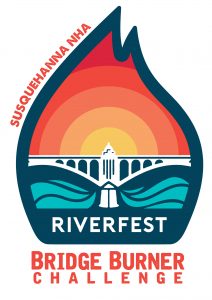
Head to the Susquehanna for Riverfest on June 27–29, 2025! Susquehanna National Heritage Area (NHA) and Rivertownes PA, USA have partnered to commemorate the Civil War burning of the world’s longest covered bridge. In June 1863, Confederate forces marched into Pennsylvania and spread across south central counties, raiding and sacking small towns. Columbia and Wrightsville joined together to protect Lancaster from the same fate. After a short battle, outnumbered Union troops and local volunteers set the wooden covered bridge that crossed the Susquehanna River ablaze. This act stopped the Confederates cold. They retreated west to a location in Adams County and, just two days later, that Army battled Union forces in the Battle of Gettysburg.
HISTORY
In June 1863, Confederate forces marched into Pennsylvania and spread across the south-central counties, to raid, and sacking small towns. Columbia and Wrightsville joined together to protect Lancaster from the same fate. After a short battle, outnumbered Union troops and local volunteers set the wooden covered bridge that crossed the Susquehanna River ablaze. This act stopped the Confederates cold. They retreated west to a location in Adams County and, just two days later, that Army battled Union forces in the Battle of Gettysburg.
BRIDGE BURNER CHALLENGE
Conquer the Bridge Burner Challenge Run & Paddle Race, a multi-sport race tracing the paths of the 1863 bridge burners. Riverfest is a weekend-long celebration of our river towns’ heritage and recreation. Susquehanna NHA, Rivertownes PA USA, and our heritage partners have created a range of experiences that tell the amazing stories of our past. Learn about the burning of the bridge story through several different heritage walks, talks, and trolley tours! Thanks to our heritage partners. Check out all the recreational trails that meander through our historic industrial landscape at the River Expo. Looking to discover on your own? Discover self-guided adventure options from Columbia Crossing River Trails Center. There are over 100 miles of trails, 10 scenic overlooks, and over 2 dozen heritage sites in the Susquehanna National Heritage Area.
SNHA invites our community members to get involved with Riverfest now! Athletes are welcome to rise to the challenge and sign up for the Bridge Burner Challenge today. Racers receive a finishers medal and t-shirt to show off their win! Save big on race fee with early race registration before May 1, 2025. Race registration is available online.
Bridge Burner Challenge
Run & Paddle Race along the Susquehanna! There’s still time register online.
EVENT SCHEDULE
Visit riverfestpa.com to register for events and plan your Riverfest experience!
Check out the event schedule. Print it yourself with this PDF or pick up a copy at Columbia Crossing & Zimmerman Center.
Donations to support heritage hosts can be made at: https://riverfestpa.com/donate/.
GET INVOLVED IN RIVERFEST WEEKEND!
Become a Riverfest sponsor to support our mission to bolster our regional economy with heritage and recreation tourism. There’s still an opportunity for our local businesses to be involved through sponsorship of this event. Sponsors have special access to event experiences and support all our heritage partners. Check out sponsor information below. Show your support for the amazing history of our river region!
Get involved in Riverfest Weekend! Visit riverfestpa.com to sign up to be a part of Riverfest Weekend. Become a volunteer to help with race support, parking, visitor services, concert support and more.
Become Recreation Partner at the River Expo.Visit riverfestpa.com to sign up to be a part of Riverfest Weekend. Our goal is to showcase the Lower Susquehanna River region’s vast recreational opportunities in Lancaster & York Counties.
We are especially thankful to our sponsors, partners, volunteers, and local communities that believe in our mission to bolster our regional economy with heritage and recreation tourism.
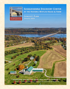
Susquehanna Discovery Center & Heritage Park
February 2025 Project Update
Pete Miele, Senior Project Leader
February has been a momentous month for the Susquehanna Discovery Center & Heritage Park! With exciting public engagement, preservation milestones, and expanded storytelling opportunities, we are making incredible strides in bringing this nationally significant site to life.
On Thursday, February 6th, we welcomed DCNR Secretary Cindy Adams Dunn to the Mifflin Farm to mark Black History Month. The event featured speeches from Susquehanna National Heritage Area (SNHA) President & CEO Mark Platts, SNHA Board members Neicy Deshields-Moulton and Nelson Polite, Jr., State Senator Kristin Phillips-Hill, and York County Commissioner Doug Hoke. These speakers honored the Mifflin House as a place of resistance and refuge in the early nineteenth century. The program was covered by Commonwealth Media Services, ABC27, Fox43, and WGAL. You can watch the full program and view high-resolution photographs here: PACast. Additional news coverage is linked here:
As part of this commemoration, SNHA President & CEO Mark Platts announced the creation of an Underground Railroad Work Group. These local historians will aid the SNHA staff in developing interpretation and exhibits for the new Underground Railroad Learning Center in the Mifflin House and on the historic landscape. The inaugural meeting of this group will occur in early March.
The story of the Underground Railroad in our region is reaching increased audiences. LNP recently released a short documentary featuring our own Senior Project Leader Pete Miele, alongside Randy Harris of LancasterHistory. The documentary highlights the significance of sites like the Mifflin House in the fight for freedom. You can watch it here: LNP Documentary. This is a fantastic opportunity to spread awareness of the powerful history embedded in our landscape.
Over the past month, River Art consultants Terrie Sultan of AMS Hudson Ferris and Rob Evans, aided by the River Art Work Group, drafted mission, vision, and purpose statements for the new Susquehanna River Art Museum. These foundational documents establish philosophies for both the permanent collection and special exhibitions of historic and contemporary art. This museum will harness the transformative, educational, and experiential power of art to tell the nationally important stories of the Susquehanna River region. We are thrilled that this unique, world-class collection of Susquehanna River Art is an integral component of the Susquehanna Discovery Center & Heritage Park.
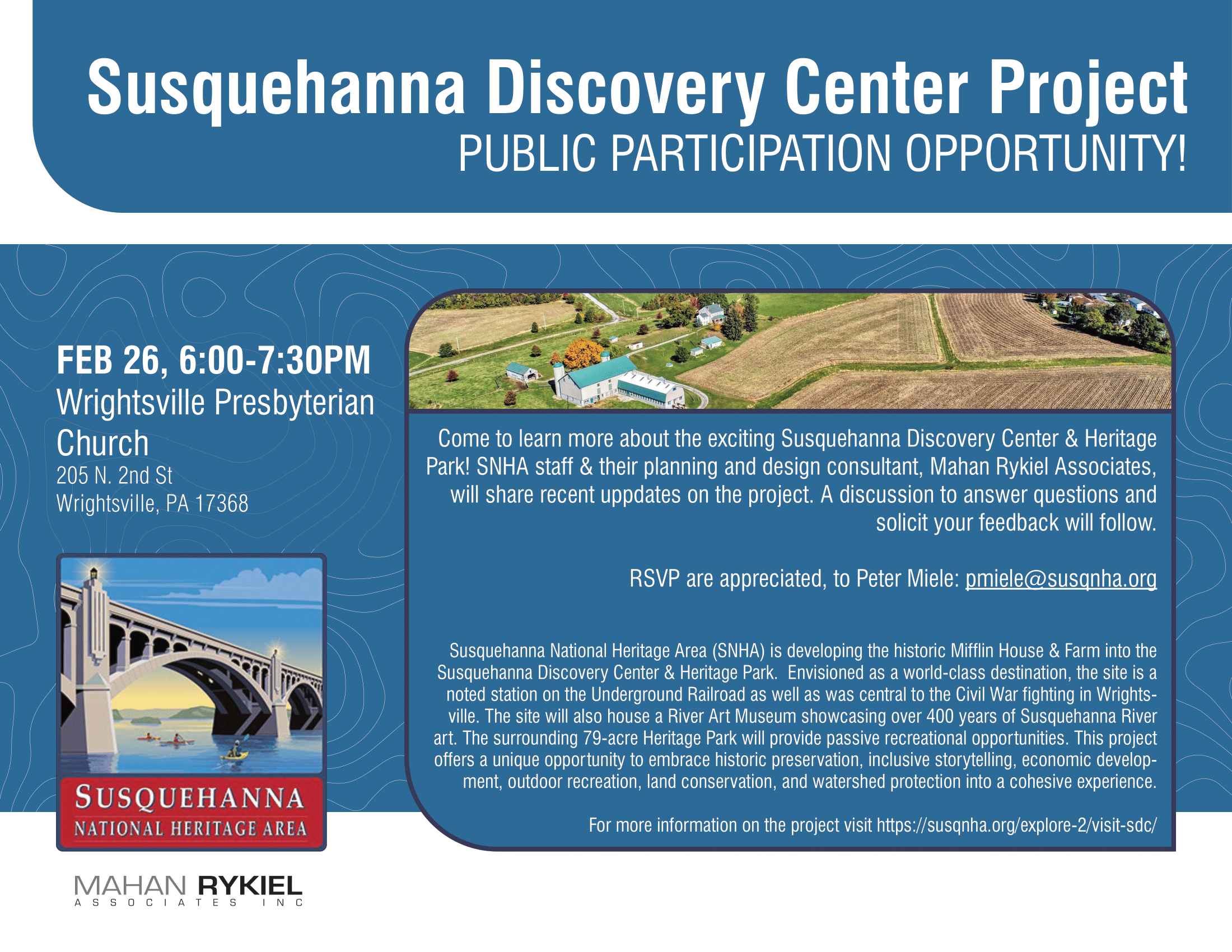
On Wednesday, February 26th, we hosted our second public presentation of the Master Plan & Interpretive Framework at Wrightsville Presbyterian Church. After seven months of effort, our Master Plan & Interpretive Framework process is nearing completion and sixty attendees joined us to learn about the future of the site. The response was positive, with the community embracing the vision for this site as a premier gateway to history, art, and nature along the Susquehanna River. Public enthusiasm reaffirms our commitment to developing a world-class visitor destination that honors the past while creating new opportunities for engagement.
Finally, February also brought thrilling news from the Pennsylvania State Historic Preservation Office: the Mifflin House has been determined “nationally significant” under the criteria for listing in the National Register of Historic Places. This is a game-changer for our project. Not only does it recognize the profound role the Mifflin House played in the Underground Railroad and Civil War history, but it also opens doors for additional grant opportunities. Our historic preservation consultant, Becky Zeller of Zeller Preservation, is now preparing the nomination form for submission to the National Park Service. We hope to achieve listing in the National Register of Historic Preservation by late 2025 or early 2026.
What’s Next?
Public Access Improvements: As we prepare to welcome visitors, work continues on initial site enhancements, including parking and walking paths. With the warmer weather, this work will restart.
Grants: We are actively applying for local, state, and federal grants to continue our work to tell the story of this property.
Educational & Community Programming: Plans are in motion for interactive tours and programs to begin this spring, ensuring that visitors can experience the Mifflin House’s story firsthand.
Thank you all for your continued support in making this vision a reality. The momentum is building, and 2025 is shaping up to be a truly transformative year for the Susquehanna Discovery Center & Heritage Park!
Susquehanna Discovery Center Project – Public Participation Opportunity!
Come Learn about the exciting Susquehanna Discovery Center & Heritage Park!
Date & Time: February 26, 6:00-7:00 PM Location: Wrightsville Presbyterian Church, 205 N. 2nd St, Wrightsville, PA 17368
The Susquehanna National Heritage Area (SNHA) team and their design consultants, Mahan Rykiel Associates, will share recent updates on the project. There will be a discussion to answer questions and solicit your feedback to follow. Click here for our latest project update
Susquehanna Discovery Center & Heritage Park
January 2025 Project Update
Pete Miele, Senior Project Leader
As we embrace the start of 2025, we’re thrilled to share the latest updates on our journey to transform the historic Mifflin House and Farm into the Susquehanna Discovery Center & Heritage Park, a vibrant hub of history, art, nature, and community engagement.
With the benefit of warm weather in November and early December, our initial public access improvements, initially, progressed quickly. As I write this, however, I am gazing out my window at the snow-covered ground, reminding me that it is still winter out there. The new driveway, parking area, and walking paths have all been graded and stoned, and now we are just waiting on paving. This will be completed once we have a few warm days in a row. We fully anticipate that the site will be ready for visitors by late winter or early spring. This vital step ensures that our community can soon experience the historic Mifflin property firsthand, laying the groundwork for engaging programs and events.
As we finish these improvements, we are turning our attention to the initial visitor experiences on the site. In December, we applied for a grant to develop interpretive panels and an orientation film that will help bring the site’s rich stories to life. This is just the beginning of our efforts to make the Susquehanna Discovery Center & Heritage Park an immersive and educational destination. In addition, we’re preparing an application for a National Endowment for the Humanities (NEH) grant to create a comprehensive interpretive plan for the site, weaving the Discovery Center, River Art Museum, Underground Railroad Learning Center, and Heritage Park together. This plan will ensure the stories of the site are thoughtfully and inclusively presented.
While public access construction wraps up, we are planning an exciting slate of public programs for summer 2025. From author talks to history and art presentations, we’re curating experiences that will connect visitors to the site’s compelling past and its relevance today. Stay tuned for details as we finalize the schedule.
The historic significance of the Mifflin House continues to inspire our preservation efforts. We are working with Becky Zeller, of Zeller Preservation, to finalize our application for listing in the National Register of Historic Places, with national significance. An SNHA team, headed by our Interpretive Specialist Barb Brundage, is completing an application to join the National Park Service’s Underground Railroad Network to Freedom. These designations will elevate the site’s national profile and cement its place as a beacon of resilience and freedom.
Amidst all this on-the-ground work, we are still deeply engaged in our Master Planning & Interpretive Framework process. We are now more than halfway done with this initiative, but there are still opportunities for public engagement. We invite everyone to join us on Wednesday, February 26th at Wrightsville Presbyterian Church (205 N. 2nd Street, Wrightsville, PA) to learn about the project and provide your input. Remember, we are designing this site for YOU.
As we continue on this journey, we thank you for your continued support. We look forward to welcoming you to the Mifflin Farm in 2025!
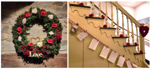
This Valentine’s Day, give a gift that promises unforgettable memories with Susquehanna National Heritage Area’s Love is Electric gift card promotion. This Valentine’s Day, gift an experience that sparks romance, adventure, and memories to cherish forever. Susquehanna National Heritage Area (SNHA) invites you to celebrate love aboard the Chief Uncas, a historic electric wood boat offering enchanting River Discovery Boat Tours along the scenic Susquehanna River.
As part of its exclusive Valentine’s Day Gift Card Promotion, SNHA presents the perfect way to say, “I love you” with a gift that’s as unforgettable as it is unique. Whether for couples, friends, or families, this offer promises a future adventure brimming with the timeless beauty of the Susquehanna.
❤️For a limited time, when you purchase a Boat Experience gift card, you’ll receive a beautiful Chief Uncas-themed Valentine’s Day card. This fun gift is the perfect way to invite your special someone to take a summer cruise together on the Susquehanna River this year!
This is more than a cruise—it’s a timeless experience, where love is electric!
Make this Valentine’s Day memorable! Give the gift of an unforgettable experience together aboard the Chief Uncas, our historic 112-year-old wooden yacht, for a 1.5-hour Premium Sunset Cruise on the Susquehanna River. Watch the sky transform as the sun sets over the river while you enjoy each other’s company. Bring your favorite food and drinks to make it the perfect evening together.
Get your Love is Electric, Chief Uncas themed Valentine’s Day card by placing an order for a Boat Experience gift card on our website before the promotion ends or while supplies last.
At checkout, choose Love is Electric Valentine’s Day Gift Card from the drop drown menu to receive your special gift. The gift card will automatically be sent digitally to your email. Pick up your Valentine’s Day Card and physical gift card at Zimmerman Center for Heritage anytime after February 1, 2025 or make it a date and plan a visit during Valentine’s Day Weekend!
Sales Start: January 6, 2025 Sales End: February 16, 2025, or while supplies last Pick Up Period: February 1, 2025 – February 16, 2025 Pick Up Location:Zimmerman Center for Heritage
Get ready to plan your future adventure together! June through October, you can choose from River Discovery Boat Tours, Specialty Themed Boat Tours, or Premium Sunset Cruises aboard the Historic Chief Uncas.
Celebrate Valentine’s Day Weekend with Susquehanna National Heritage Area!
Make this Valentine’s Day truly special by exploring the Zimmerman Center for Heritage from
Friday, February 14 to Sunday, February 16, 2025, for a celebration of love that you won’t forget!
Love on the Susquehanna History Tour
Learn the fascinating history of Valentine’s Day and hear real-life love stories that have shaped Pennsylvania’s past. Presented at 11am, 1pm, and 3pm each day. RSVP for this unique Valentine’s Day experience at susqnha.org/events/
Historic Valentines on Display
See romantic letters written by couples from York and Lancaster counties, on display at the Zimmerman Center courtesy of the York History Center and LancasterHistory.
Fun Photo Opportunity
Snap a photo with your loved one surrounded by our special Valentine’s Day decorations!
Surprise Gift
Make your loved one feel extra special by surprising them with a boat experience gift card for a romantic cruise this summer aboard SNHA’s historic tour boat, the Chief Uncas.
Susquehanna Discovery Center & Heritage Park
November 2024 Project Update
Pete Miele, Senior Project Leader
The Susquehanna Discovery Center & Heritage Park (SDC) project continued to make impressive strides during the last month. Master Planning and community engagement efforts are building momentum, laying out a vision that we hope will inspire locals and visitors alike.
In late October, our Master Planning consultants from Mahan Rykiel Associates (MRA) delivered presentations to our SDC Task Force, SNHA Board, and members of the community, gathering valuable insights to shape the future of this cultural landmark. The presentations centered on the project’s multifaceted goals, which include celebrating history, art, and the natural landscape. The public meeting welcomed input from more than sixty community members, eager to learn more about the project’s scope and goals. Attendees posed thoughtful questions about the integration of the SDC into Wrightsville and Hellam Township and its alignment with local heritage sites, such as York’s Goodridge Freedom Center and Lancaster’s Thaddeus Stevens & Lydia Hamilton Smith Center for History and Democracy. This collaborative spirit has reaffirmed our focus on creating a hub that honors diverse histories while offering a dynamic experience for repeat visitors.
On the ground, October marked a significant milestone with the commencement of initial construction efforts to enhance public access to the site. This long-awaited step includes the development of a driveway, parking area, and ADA-accessible pathway. These efforts are foundational in ensuring that visitors will soon be able to access this historic space safely and comfortably. We expect this initial infrastructure to be completed by years’ end, making way for guided tours and community events as early as spring.
Our River Art Work Group made strides toward integrating the River Art museum as part of SDC. This museum will highlight the influence of the Susquehanna River on American landscape art, preserving and celebrating the legacy of artists who have drawn inspiration from this majestic river. The group is discussing strategies to showcase a wide range of Susquehanna-inspired art that spans several centuries, depicting the natural beauty and cultural history of the region. One such strategy is to include a changing exhibit gallery, which will accommodate traveling exhibits and allow the museum to focus specific themes relating to the collection, as well as provide opportunities for ongoing community engagement. Over the next few months, we will work to develop an official name for the museum, as well as a case statement, guiding principles, and a mission and vision.
Looking ahead, we are excited to further refine the interpretive framework and design elements with MRA, aiming for a cohesive blend of educational programming, artistic engagement, and natural beauty that honors both the site’s historical significance and its future as a central Pennsylvania heritage destination. This month’s progress would not have been possible without the continued support from our dedicated partners and the community’s invaluable feedback. Together, we are shaping a space that will be a lasting testament to the Susquehanna region’s legacy and a beacon for future generations.
Historic Mifflin House & Farm Saved for Future Generations Preservation Celebration Marks the Beginning of Susquehanna Discovery Center & Heritage Park Development
Wrightsville, PA — On Friday, September 27th, Susquehanna National Heritage Area (SNHA) celebrated a significant milestone in the preservation of Pennsylvania’s heritage. More than 60 people gathered with SNHA staff at the historic Mifflin House & Farm for a Preservation Celebration & Initial Groundbreaking. This event marked the culmination of a seven-year effort to protect this invaluable site from development and set the stage for its transformation into the Susquehanna Discovery Center & Heritage Park—a project expected to span five to ten years.
The Mifflin House, a documented stop on the Underground Railroad, and the 160-year-old barn will be rehabilitated and eventually opened to the public as part of this expansive project. A museum showcasing an extraordinary collection of Susquehanna River art will have a home on the property, bringing to life the region’s rich cultural and natural history. The 79-acre landscape will feature walking trails interpreting the Underground Railroad and the Civil War battle that occurred in Wrightsville, a pivotal event in the 1863 Gettysburg Campaign.
Private, state, and federal sources have already committed more than $8 million to the projected $25 million development.
“This is a landmark moment for the preservation of not only our local history but also for the broader narrative of American history,” remarked Mark Platts, President & CEO of SNHA. “We look forward to working with the community to ensure the Mifflin House continues to be a beacon of cultural significance for generations to come.”
The first phase of development, set to begin this fall, includes the construction of a new driveway, 30 parking spaces, and an ADA-accessible pathway through the farmstead. These improvements will open the historic site to the public for the first time in more than 225 years, with preview tours expected to begin in spring 2025.
About the Susquehanna Discovery Center & Heritage Park
The Susquehanna Discovery Center & Heritage Park will be a world-class destination within America’s 55th National Heritage Area. The site will feature a gateway visitor center housed in a historic Pennsylvania bank barn, introducing visitors to the unique stories of Lancaster and York Counties. The River Art Museum will showcase over 400 years of Susquehanna River art, while a Learning Center will be located within the historic Underground Railroad station. The surrounding 79-acre Heritage Park will provide immersive interpretation of the 1863 Battle of Wrightsville, combining historic preservation, inclusive storytelling, economic development, outdoor recreation, land conservation, and watershed protection into a cohesive experience.
About Susquehanna National Heritage Area
The Susquehanna National Heritage Area is a designated State and National Heritage Area dedicated to preserving, interpreting, and sharing the natural, cultural, and historic resources of Lancaster and York Counties. Through collaborative efforts, SNHA fosters a deeper appreciation for the unique communities and landscapes along the Susquehanna River, ensuring that future generations can explore and learn from this rich heritage.
Contact: Peter Miele, Senior Project Leader, Susquehanna National Heritage Area pmiele@susqnha.org
717-252-0227 x107
River Roots is Susquehanna NHA’s blog series featuring history from York and Lancaster Counties that showcases the Susquehanna River’s historical, cultural, and natural resource contributions to our nation’s heritage.
Susquehanna NHA is pleased to introduce guest blog writers, Jean-Paul Benowitz, Director of Public Heritage Studies at Elizabethtown College, and Eric Schubert public historian and genealogist.
Have you ever seen a sign reading “Historic Haldeman Mansion” along Pennsylvania State Route 441 in Bainbridge? Did you know, that in the nineteenth century, an internationally renowned scientist and philologist lived along the banks of the Susquehanna? Samuel Haldeman was dubbed the “Sage of Chiques” for his expansive knowledge and publications on science, history, and languages.
Locust Grove and the Haldeman Homestead
In 1784, Samuel’s grandfather, John Haldeman acquired land in Conoy Township. He called the Haldeman family estate Locust Grove. John inherited the Haldeman Homestead farm from his father-in-law. The property included a house, stone kitchen, smokehouse, barn, mill, still house, and sawmill. The home, now Haldeman Mansion, was originally a 1730s German vernacular house. In 1811, John and his wife, Maria Brennerman Haldeman, expanded the house into a mansion and remodeled it in the Federalist style. John also built a grist mill and distillery at the mouth of the Conoy Creek.
In 1804, John’s oldest son, John Brenneman Haldeman, moved to Locust Grove Estate to manage the sawmill, gristmill, and distillery. Later, John Brenneman Haldeman returned to the Haldeman Family Homestead to manage the farm. His brother, Henry Haldeman, took charge of the industries at Locust Grove.
Samuel Haldeman: Early Education
Samuel Stehman Haldeman was born at Locust Grove on August 12, 1812, to Henry and Frances Stehman Haldeman. As a child, Samuel read extensively from books in his father’s library. He taught himself about natural history by collecting specimens of shells, insects, birds, and minerals. Samuel learned how to observe and stuff birds and mammals from a traveling Methodist minister. He collected the skeletons of rabbits, opossums, muskrats, and field mice as natural history specimens.
The Locust Grove property was part of a Native American village site dating back to 1200. Samuel made archaeological digs at Locust Grove and collected artifacts from Shenks Ferry, Susquehannock, and Conoy people. After Samuel’s death, the National Register of Historic Places and the Historic Preservation Trust of Lancaster County recognized the Haldeman Mansion for important Native American artifacts found there.
Samuel attended Dr. John Miller Keagy’s Classical Academy in Harrisburg at fourteen. The school is now called Harrisburg Academy. Two years later, Samuel enrolled with the class of 1831 at Dickinson College in Carlisle. For two years, he studied there under the geologist Henry Darwin Rogers.
Iron Industry
In 1828, Samuel’s father Henry bought several mills at the mouth of the Chikiswalungo (or Chiquesalunga) Creek in Marietta. In 1845, Henry and another son, Dr. Edwin Haldeman, established E. Haldeman and Company. They built an anthracite furnace west of Chickies Rock. Samuel and his brother Edwin managed the new enterprise. Samuel named the iron works company after the Native name of the nearby creek, meaning “place of the crabs,” hence Chikiswalungo Furnace. In 1858, when locals shortened the creek’s name, Samuel reluctantly approved changing the furnace’s name to Chickies Furnace.
Edwin, Paris, and Cyrus Summerfield Haldeman (Samuel’s brothers) eventually took over the business management. Samuel concerned himself with studying the scientific and technological aspects of iron smelting. In 1848, Samuel wrote two scholarly articles on the benefits of anthracite coal over traditional charcoal furnaces.
Image Courtesy Rivertownes PA USA
Personal Life
Despite being raised in the Anabaptist tradition of his Swiss German ancestors, Samuel converted to Roman Catholicism in the 1840s after studying comparative religions. Samuel belonged to St. Mary’s Church in Lancaster City and later St. Peter’s Church in Columbia. In 1869, Samuel raised funds for St Peter’s to build the Presentation of the Blessed Virgin Mary Church in Marietta.
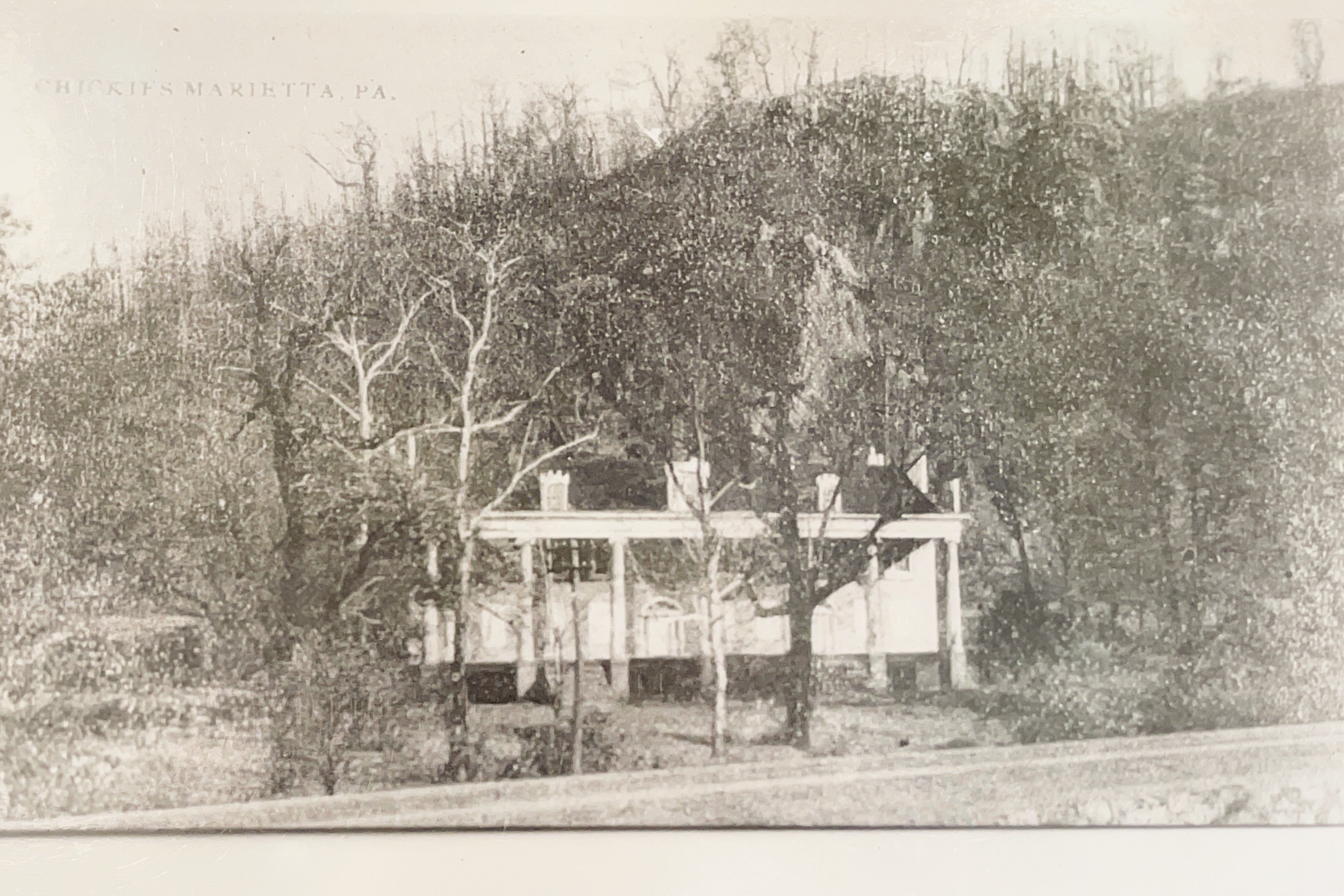
In 1835, Samuel married Mary Ann Hough of Bainbridge and the couple had two sons and two daughters. After their wedding, Samuel and Mary moved to a new home in Marietta at the base of Chickies Rock. In 1833, Samuel designed the Greek Revival-style mansion and named it Rock Retreat. He filled the extensive gardens with native specimens of trees and shrubs.
Academic Achievements
From 1833–1834, Samuel attended natural history lectures in the Medical Department at the University of Pennsylvania. In 1835, Samuel wrote an article for the Lancaster Journal refuting the Great Moon Hoax, a sensational story claiming that there was life on the moon.
In 1836, Henry Darwin Rogers, Samuel’s former professor and Pennsylvania state geologist, put Samuel in charge of geology field operations in New Jersey. In 1837, Samuel returned to Pennsylvania to assist with Professor Roger’s state geology survey. Samuel personally surveyed Dauphin and Lancaster counties.
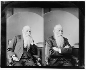
Photo Courtesy Library of Congress
In 1840, Samuel returned to Rock Retreat, where he studied the natural history of invertebrates. He was especially interested in the taxonomy of beetles and freshwater mollusks. In 1842, Samuel established the Entomological Society of Pennsylvania. It was the first scientific society formed to study insects in America. Members of the society published hundreds of descriptions of American insects and gathered the first permanent insect collections in the country. In 1842, Samuel published his first entomological paper and became a Professor of Zoology at the Franklin Institute in Philadelphia. His lectures were the basis for many articles published in natural science journals.
In 1842, Samuel published his Monograph on the Freshwater Mollusca of the United States in the Conchological Section of the Academy of Natural Sciences. Samuel described Scolithus linearis as a trace fossil of some burrowing organism. It was the most ancient organic remains known at the time. Samuel was a member of the Academy of Natural Sciences in Philadelphia. In 1844, Samuel joined the American Philosophical Society. He was one of the founding members and served as its president from 1876-1877.
In 1844, Samuel wrote a paper on freshwater mollusks that defended Lamarckian evolution and transmutation of species. In 1848, U. S. Navy Rear Admiral Charles Wilkes asked Samuel to study the specimens discovered on his expedition of the Pacific Ocean.
Samuel’s eyesight began to deteriorate, but his hearing became remarkably sensitive. He discovered a new sound organ in Lepidopterous insects, which he described in Benjamin Silliman’s American Journal of Science. In 1848, Samuel published an article on his discovery of sound organs in certain moths. From 1851-1852, Samuel edited the Pennsylvania Farmer’s Journal.
Samuel chaired meetings about and wrote award-winning articles on English spelling reform. In 1875, Samuel joined a committee to review Noah Webster’s new spelling and determine necessary changes to the English language. Samuel contributed to Worchester’s Dictionary, the National Dictionary, and Johnson’s Cyclopedia. In 1868, Samuel became the first chair of the Department of Comparative Philology at The University of Pennsylvania.
Samuel was especially interested in the languages of Indigenous people in the U. S. and abroad. He traveled in America and internationally to study many languages. Samuel met visiting tribal delegations in Washington, D. C., and requested Indigenous vocabularies from Western naturalists. In 1849, Samuel established a reputation as an eminent philologist by presenting a paper at the American Association for the Advancement of Science and the American Academy of Arts and Sciences meetings.
Samuel introduced a new, more empirical approach to the study of languages. He studied Indian, Chinese, and English dialects. Samuel published scholarship on the Pennsylvania Dutch dialect. He even wrote the first Pennsylvania Dutch dictionary. During six trips abroad between 1847 and 1875, Samuel investigated multilingual areas in Europe. When studying the human voice in Rome, Samuel determined the vocal repertoire of 40–50 varieties of human speech. Samuel wrote widely on linguistic topics such as the pronunciation of Latin terms for naturalists, the relationship between Chinese and Indo-European languages, the origin and use of prefixes and suffixes in Pennsylvania Dutch, and a general outline of etymology.
Samuel was a Professor of Natural History at the University of Pennsylvania from 1851-1855. Samuel accepted a similar professorship at Delaware College (now the University of Delaware) while lecturing on geology and chemistry at the State Agricultural College of Pennsylvania (Now Pennsylvania State University). In 1851, Samuel visited Texas to explore the presidency of an academic institution there, but he declined the position. On his return trip from Texas, Samuel was offered the position of president of Masonic College in Selma, Alabama. He accepted and held the position from January to October 1852. That same year, he described the insects collected by Captain Howard Stansbury’s 1849 geographical survey of Utah’s Great Salt Lake.
In 1861, Charles Darwin wrote an acknowledgment of Samuel’s ideas supporting the theory of evolution in a preface to his, On the Origin of Species. Samuel authored 150 publications including important works on entomology, conchology, and philology; 120 were scientific and 30 were linguistic. Twenty-eight scientific societies worldwide gave Samuel honorary memberships.
Samuel was fascinated by exercise physiology. On one of his many trips to Paris, Samuel discovered a French gymnastic apparatus and studied the benefits of physical exercise. Samuel’s physician, his brother Edwin, prescribed outdoor exercise. Samuel, therefore, hiked Chiques Rock and did archeology fieldwork there. At Chiques Rock, Samuel discovered and excavated an Indigenous prehistoric settlement. In 1878, Samuel read a report before the American Philosophical Society, about his archaeological fieldwork at a prehistoric cave on his Rock Retreat property in Marietta. He published the report in 1881 as a monograph in the Transactions of the American Philosophical Society.
Samuel became known as the “Sage of Chiques.” Letters of inquiry from all over the world came across Samuel’s desk in Rock Retreat in Marietta. Publishers and editors asked for his opinions on and reviews of books. Writers and teachers inquired about pronunciation, spelling, and natural history facts. Naturalists forwarded packages of shells, insects, or minerals for identification, and farmers sent clays for analysis. Scientific journals and institutions sent invitations to lecture and requests for data.
On Friday, September 10, 1880, Samuel returned home to Rock Retreat from the American Association for the Advancement of Science meeting in Boston. That night, he had a heart attack and died at the desk in his study at age 68. Samuel was buried in the Haldeman family plot at the Marietta Cemetery on West Fairview Avenue in Marietta.
In 1911, when the Haldeman iron business sold their property and demolished their furnaces, they also tore down Rock Retreat. In 2018, the East Donegal Rotary Club and Rivertownes PA USA erected a historical marker on the Northwest Lancaster County River Trail at the location of Samuel’s Greek Revival mansion.
In 1991, the Pennsylvania Historical and Museum Commission dedicated a Pennsylvania Historical Marker to Samuel. It is located along Pennsylvania State Route 441 north of the Locust Grove Estate. In 2018, the Pennsylvania Department of Environmental Protection recognized Samuel as one of forty-one men and women who shaped Pennsylvania’s environmental heritage.
Today the Haldeman Mansion is a public historic site administered by the Haldeman Mansion Preservation Society. In 1967, local historic preservationists formed the Haldeman Society to rehabilitate Locust Grove. In 1977, the Haldeman Mansion was placed on the Pennsylvania and National Register of Historic Places. It is number six on the inventory of historic buildings of the Historic Preservation Trust of Lancaster County.
When Samuel died, the Columbia landscape and portraiture artist Lloyd Mifflin, known as “America’s greatest sonneteer,” wrote these lines:
The Storm Clouds In Memory of Samuel S. Haldeman, L. L. D.
I stand beside the River as the night
Unrolls her sombre curtain o’er the day;
The pyres within the west have paled away
And only left their embers, dimly bright,
To illume the sullen hill-top’s purple height;
Then, from behind the crags, the clouds of gray-
A troop of lions held too long at bay-
Arise from out their antres in their might,
And low along the mountain ridges prowl,
Tossing their shaggy manes with lordly roar;
While, by the lash of lightning still uncowed,
They, raging and rebellious, long and loud,
Send many angry and deep-throated growl
Rumbling along the caverns of the shore!
Meet the Guest Writer Jean-Paul Benowitz
Jean-Paul Benowitz teaches history at Elizabethtown College where he is the Director of Public Heritage Studies. Since 1993 he has been on the faculty teaching in the Departments of History and Religious Studies. He earned his BS in History at Eastern Mennonite University where he wrote his senior thesis on the history of the Horse and Buggy Mennonites of Virginia. He earned his MA in History at Millersville University where he wrote his MA thesis on the history of the Horse and Buggy Mennonites of Pennsylvania and Virginia. He was a scholar in residence at Elizabethtown College’s Center for Anabaptist Studies. During this time, he authored several scholarly articles and books about Pennsylvania Dutch Culture. He teaches community-based learning Honors courses about local history and historic preservation; particularly related to the National Historic District of Marietta and the Chickies National Historic District. These courses have been recognized by the National Collegiate Honors Council where he serves on national committees for teaching and advising honors students and has authored monographs published by NCHC about teaching honors students. He has authored books about local history, articles about the Historic Peace Churches, and a column in the local newspaper in Elizabethtown about local history. Jean-Paul did his doctoral work at Temple University. His dissertation is a biography of U. S. Congressman James Wadsworth Symington who worked in the Eisenhower, Kennedy, and Johnson administrations. Much of Jean-Paul’s scholarship, published works, and public presentations have focused on 20th-century American political history, particularly presidential studies, and international relations. This has been the foundation for Honors courses he teaches about leadership in the Honors Program where he is an academic advisor and where he directs the Office of Prestigious Scholarships and Fellowships. Jean-Paul has been active in the Historic Harrisburg Association and Historic Preservation Trust of Lancaster County. The Historic Preservation Trust of Lancaster County presented Jean-Paul with the Smedley Award which is given to an educator who has shown extraordinary support for historic preservation in Lancaster County.
Meet the Guest Writer Eric Schubert
Eric Schubert, public historian, is an internationally recognized genealogist and forensic genetic genealogist with over ten years of research experience. A recent graduate of Elizabethtown College, he is a current History M.A. candidate at Millersville University. His journey helping individuals through genealogy began at the age of ten and has led to countless reunifications – as well as several solved cold cases. Features include People Magazine, The New York Times, The Washington Post, Good Morning America, and various other publications. His public history work throughout Lancaster County, often related to historic preservation and biography of the Marietta area, has been highlighted in Lancaster Online and Community Press. At Elizabethtown College Eric led a National Trust for Historic Preservation, This Place Matters Campaign, for the National Historic Districts of Marietta and Chickies, celebrating the role these places played, particularly Marietta Restoration Associates, Inc. in establishing a national historic preservation movement in the 1960s and especially in the aftermath of Hurricane Agnes 1972.
Sources
Ancestry.com, “Online Family Trees,” accessed March 12, 2024,
https://www.ancestry.com/search/collections/1030/
Barber, Edwin A.”The Late Professor S.S. Haldeman” The Museum; 1885. MG-344 S. S.
Haldeman Papers, Lancaster County Historical Society.
Biographical Annals of Lancaster County, Pa., Beers, 1903, pp. 144-5.
Brinton, D. G. “Memoir of S. S. Haldeman, A. M., Ph. D., etc.” Proceedings of the American
Philosophical Society. 1881, 19 (108): 279–285.
Croll, P. C. “Famous Pennsylvania Germans; Professor Samuel S. Haldeman, LL.D.” The
Pennsylvania German, v.6 1905.
Gramm, Bertha Sue. The Ironmasters of Marietta and Vicinity During the Period 1848-
1878, Lancaster County Historical Society: Lancaster, PA. 1948.
Haldeman, Horace L. “A Memoir of Prof. Samuel Steman Haldeman. LL. D.” Records of the
American Catholic Historical Society of Philadelphia. 1898, 9 (3): 257–292.
Hamersly, Lewis Randolph, ed. Who’s Who in Pennsylvania; Containing Authentic Biographies
of Pennsylvanians Who are Leaders and Representatives in Various Departments of
Worthy Human Achievement … New York: L. R. Hamersly Company, 1904.
Hart, Charles Henry. Memoir of Samuel Stehman Haldeman, LL.D., Professor of Comparative
Philology in the University of Pennsylvania, Philadelphia: Press of E. Stern & Co., 1881.
Lancaster County Historical Society, S. S. Haldeman Papers.
Landis, Hunt Maragret. “War of the Words, or Which Came First, Chiques or Chickes?” The
Journal of Lancaster County’s Historical Society, 2009, 111 (1): 12-27.
Malone, Dumas, ed. Dictionary of American Biography, New York: Charles Scribner’s Sons,
1932.
Men of Science and Industry: A Guide to the Biographies of Scientists, Engineers, Inventors and
Physicians, in the Carnegie Library of Pittsburgh, Pittsburgh: Carnegie Library, 1915.
Sorensen, W. Conner. “Haldeman, Samuel Stehman (1812-1880), Naturalist and Philologist,”
American National Biography, 1999.