Android App Launched for Susquehanna NHA
Susquehanna NHA Creates Local Trail Application with help from Franklin & Marshall College
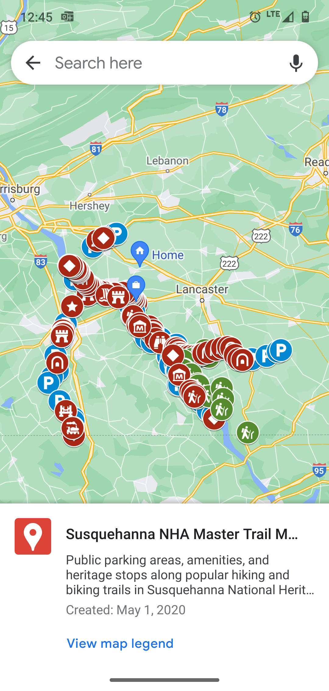
Susquehanna National Heritage Area works with partners and communities in Lancaster and York Counties to showcase our area as a destination for cultural discovery and outdoor adventure. During the global pandemic, Susquehanna NHA focused on creating self-guided heritage and outdoor exploration tools, while our visitor centers were temporarily closed. One of those tools is a custom map created on the Google Maps platform. Users of the map can explore the Northwest Lancaster County River Trail and learn historical, geological, and natural facts on their trip. When visitor facilities like Columbia Crossing River Trails Center reopened these digital tools continued to be popular with trail users.
In early 2021, Franklin & Marshall College reached out to the community to offer development of a mobile application. Professor Ed Novak led the computer science course in which groups of students would develop fully-functional Android app prototypes for community partners. Susquehanna NHA applied to participate and was chosen as one of four projects. Susquehanna NHA’s Columbia Crossing Director, Hope Byers was the lead on the collaboration. “Our goal was to take the popular Google Map and expand it beyond a single trail so visitors and residents would have a single-source trail information app. Since opening, Columbia Crossing has fielded everything from maintenance requests to heritage questions about all riverfront trails and we want to put all that knowledge at the fingertips of trail users.”
Susquehanna NHA staff members Hope Byers and Megan Salvatore worked to expand information on the custom map while Franklin & Marshall College students developed the code. The Franklin & Marshall students assigned to the project were Rafael Silva, Waleed Kamal Butt, Molly Sproul, Quang Anh Tran, and Thu Do. The students met virtually with Hope on a weekly basis to discuss the project. “It was obvious that these were passionate, dedicated students. They managed the project so professionally and really treated it as if I was their client. They taught me how to use tools to keep the app functioning, send notifications, and walked me through the app launch. Susquehanna NHA is so grateful for their dedication to create not just a prototype but a live application” said Hope Byers.
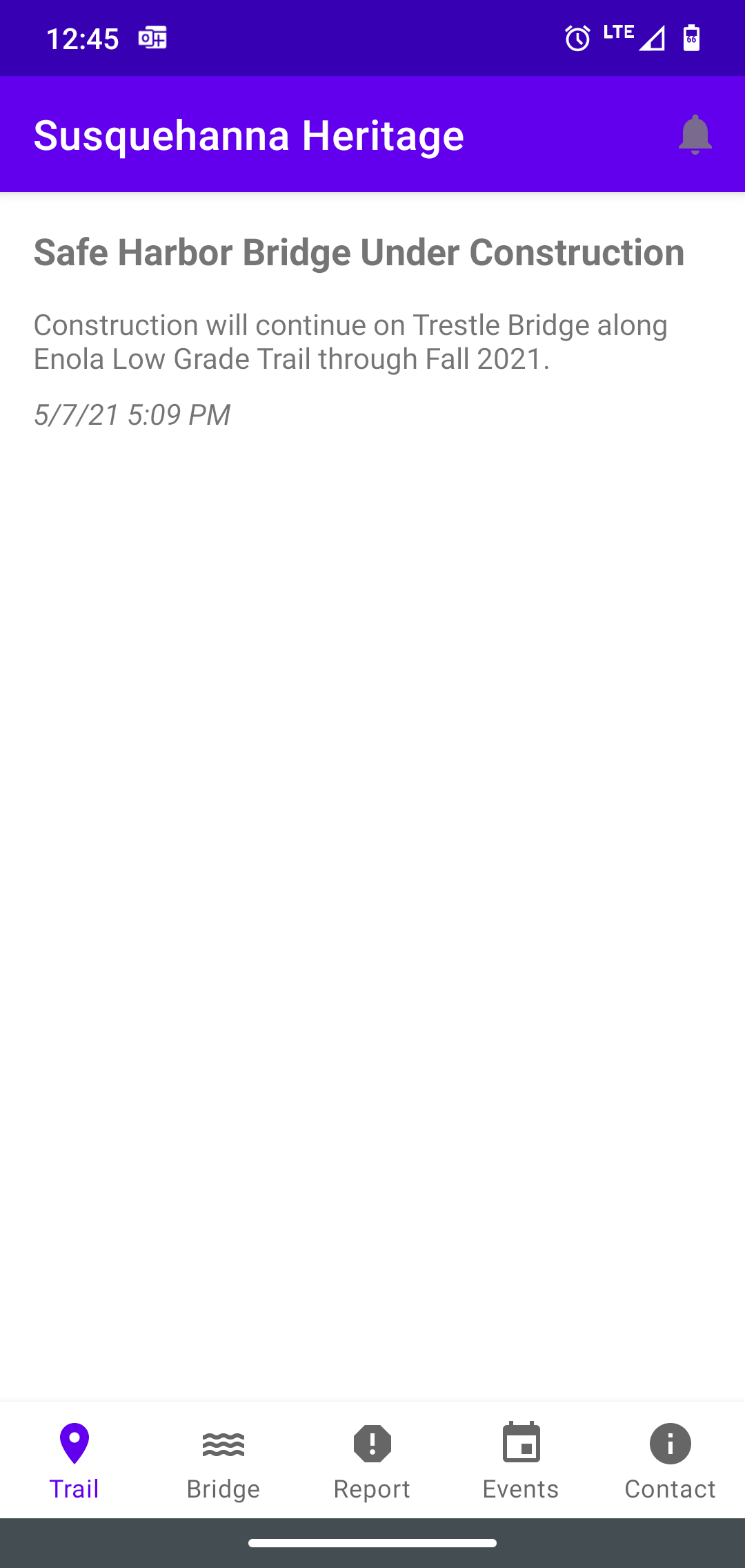
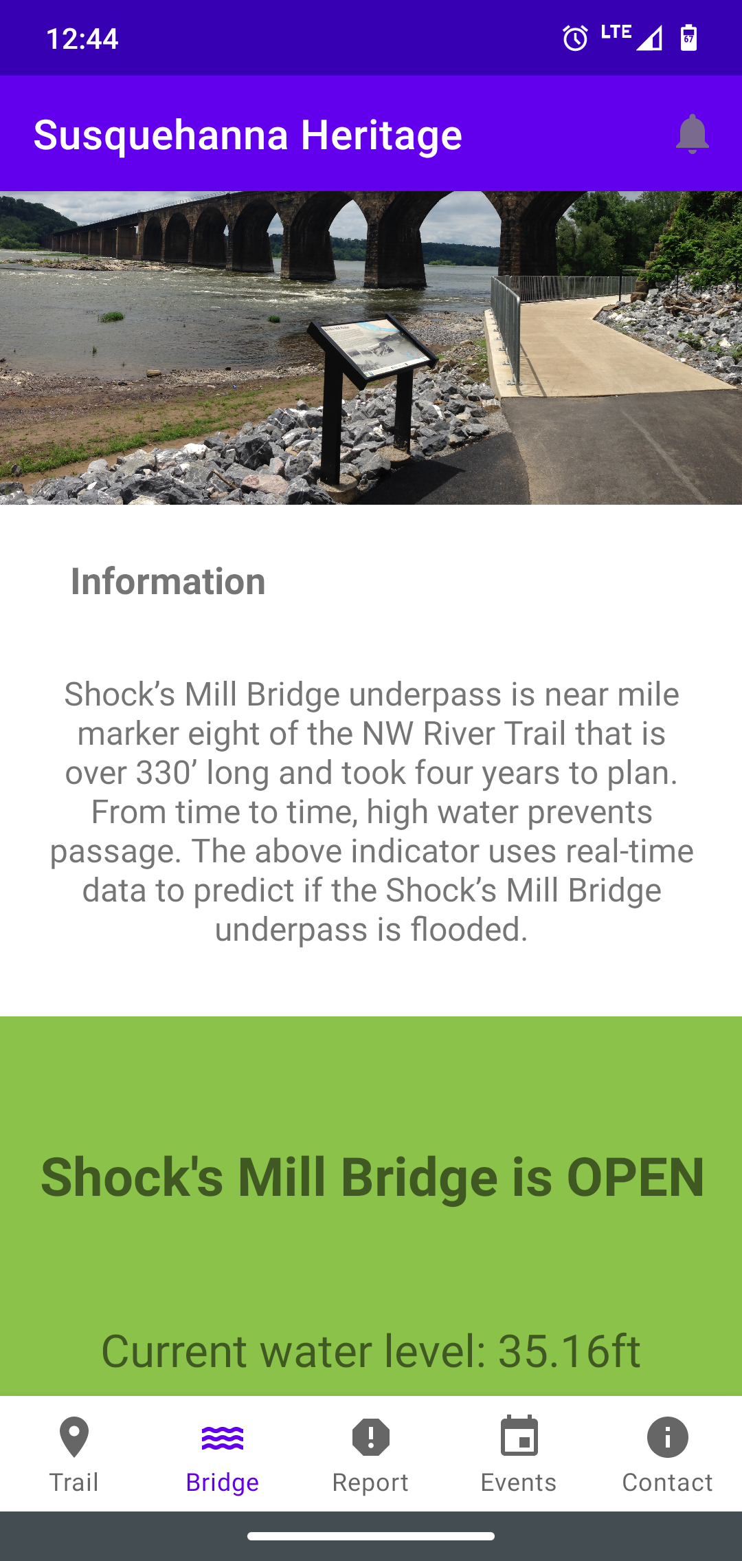
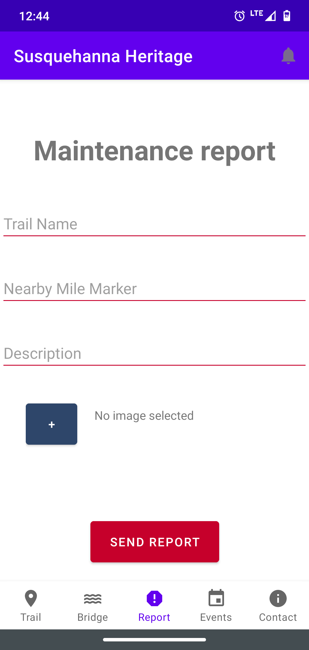
In the short, three-week project, the students were able to create an application that did a variety of helpful actions. First, the app connects users to trail information using the Google Map that Susquehanna NHA created. In the map, trail access areas, parking information, restroom facilities, and interesting heritage sites are listed individually for major regional trails and nature preserves. The app also allows Susquehanna NHA to send notifications about trail updates or construction. Users can also check to see if the James D. Warner Passageway under the Shock’s Mill Bridge on the Northwest Lancaster County River Trail is flooded. This waterfront passageway floods during spring freshets and on occasion in the summer. There is no available trail detour, so it is helpful for users to check before hitting the trail. The application has event and contact information for Susquehanna NHA to better connect our community to riverfront initiatives. Susquehanna NHA and local trail partners are particularly excited about one feature of the app which allows users to submit trail maintenance requests. Trail users can submit the trail name, mile marker, and photo of an issue. This interactive component will help trail managers keep our local trails clear and accessible.
Android users are invited to find the app by searching Susquehanna NHA Trails in the Google Play store. The application is not currently available on the Apple Store; however, you can access the custom Google Map on our Maps & Guides page.